Area Overview for SN11 8EB
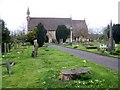
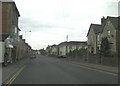
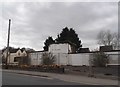
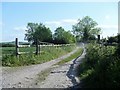
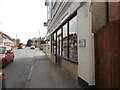
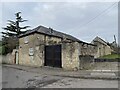
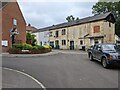
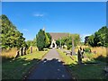
Photos of SN11 8EB


![Alongside the brook [1] in SN11 8EB](https://images.propbar.co.uk/images/geograph/54/17/5417938_120.jpg)
![Alongside the brook [2] in SN11 8EB](https://images.propbar.co.uk/images/geograph/54/17/5417941_120.jpg)
49 photos from this area
Area Information
Key information about the SN11 8EB including its size, population, and administrative classification.
- Area Type
- Postcode
- Area Size
- 3512 m²
- Population
- 1392
- Population Density
- 3233 people/km²
House Prices in SN11 8EB
8
Properties
£233,500
Average Sold Price
£41,500
Lowest Price
£350,000
Highest Price
Showing 8 properties
| Address | Type | Beds | Baths | Last Sale Price | Last Sale Date | |
|---|---|---|---|---|---|---|
| 110 Anchor Road, Calne, SN11 8EB | Detached | 2 | 1 | £350,000 | Aug 2025 | |
| 112 Anchor Road, Calne, SN11 8EB | Cottage | 3 | 1 | £305,000 | Mar 2025 | |
| 81 Anchor Road, Calne, SN11 8EB | Retail | 2 | 2 | £237,500 | Dec 2022 | |
| 106 Anchor Road, Calne, SN11 8EB | Detached | - | - | £41,500 | Mar 1998 | |
| 79 Anchor Road, Calne, SN11 8EB | Terraced | 3 | - | - | - | |
| 77 Anchor Road, Calne, SN11 8EB | Cottage | 3 | - | - | - | |
| 108 Anchor Road, Calne, SN11 8EB | Detached | - | - | - | - | |
| 83 Anchor Road, Calne, SN11 8EB | house | - | - | - | - |
Energy Efficiency in SN11 8EB
Amenities
Schools
| Rank | School | Type | Entry gender | Ages |
|---|
Explore more schools in this area
Go to Schools tabDemographics
Household Size
Two person
most common
Accommodation Type
Houses
most common
Tenure
58
majority
Ethnic Group
White
most common
Religion
N/A
most common
Household Composition
N/A
most common
Age
47
median
Adults (30-64 years)
most common
Household Deprivation
N/A
with no deprivation
NS-SEC
28
in Lower managerial occupations
Explore more demographic insights in this area
Go to Demographics tabPlanning
Planning Constraints
- Flood RiskPremium
- Ramsar Wetland SitesPremium
- Area of Outstanding Natural BeautyPremium
- Protected Nature ReservePremium
- Protected WoodlandPremium