Area Overview for SN11 0PL
Photos of SN11 0PL

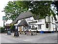
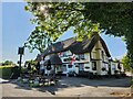
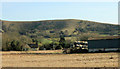
![Hampsley Hollow Riding Centre [1] in SN11 0PL](https://images.propbar.co.uk/images/geograph/58/00/5800021_120.jpg)

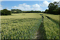
26 photos from this area
Area Information
Key information about the SN11 0PL including its size, population, and administrative classification.
- Area Type
- Postcode
- Area Size
- 1.4 hectares
- Population
- 2582
- Population Density
- 88 people/km²
House Prices in SN11 0PL
6
Properties
£337,500
Average Sold Price
£180,000
Lowest Price
£495,000
Highest Price
Showing 6 properties
| Address | Type | Beds | Baths | Last Sale Price | Last Sale Date | |
|---|---|---|---|---|---|---|
| Wakers Mead, Heddington, Heddington, SN11 0PL | Bungalow | - | - | £495,000 | Jul 2013 | |
| Holmleigh, Heddington, Heddington, SN11 0PL | Detached | 4 | 2 | £180,000 | Feb 2004 | |
| Staff Accommodation, Ivy Inn, Heddington, Heddington, SN11 0PL | Flat | - | - | - | - | |
| Home Farm Barn, Heddington, Heddington, SN11 0PL | Semi-detached | - | - | - | - | |
| Home Farm, Heddington, Heddington, SN11 0PL | Detached | - | - | - | - | |
| Ivy Inn, Heddington, Heddington, SN11 0PL | restaurant_cafe | - | - | - | - |
Energy Efficiency in SN11 0PL
Amenities
Schools
| Rank | School | Type | Entry gender | Ages |
|---|
Explore more schools in this area
Go to Schools tabDemographics
Household Size
Two person
most common
Accommodation Type
Houses
most common
Tenure
75
majority
Ethnic Group
White
most common
Religion
N/A
most common
Household Composition
N/A
most common
Age
47
median
Adults (30-64 years)
most common
Household Deprivation
N/A
with no deprivation
NS-SEC
43
in Lower managerial occupations
Explore more demographic insights in this area
Go to Demographics tabPlanning
Planning Constraints
- Flood RiskPremium
- Ramsar Wetland SitesPremium
- Area of Outstanding Natural BeautyPremium
- Protected Nature ReservePremium
- Protected WoodlandPremium