Area Overview for SN10 5TH
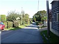
Photos of SN10 5TH
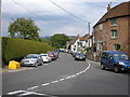
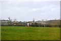
![Houses in Great Cheverell [1] in SN10 5TH](https://images.propbar.co.uk/images/geograph/55/73/5573891_120.jpg)

40 photos from this area
Area Information
Key information about the SN10 5TH including its size, population, and administrative classification.
- Area Type
- Postcode
- Area Size
- 4.9 hectares
- Population
- 2153
- Population Density
- 78 people/km²
House Prices in SN10 5TH
32
Properties
£484,597
Average Sold Price
£120,000
Lowest Price
£1,875,000
Highest Price
Showing 32 properties
| Address | Type | Beds | Baths | Last Sale Price | Last Sale Date | |
|---|---|---|---|---|---|---|
| Rosemary Cottage, 24 High Street, Great Cheverell, SN10 5TH | Detached | 4 | 2 | £800,000 | Feb 2025 | |
| Belle Ville, 21 High Street, Great Cheverell, SN10 5TH | Detached | 5 | 3 | £420,000 | May 2022 | |
| Walnut Tree Cottage, 52 High Street, Great Cheverell, SN10 5TH | Detached | - | - | £1,875,000 | Sep 2021 | |
| Amberley Cottage, 26 High Street, Great Cheverell, SN10 5TH | house | - | - | £655,000 | Dec 2017 | |
| 37 High Street, Great Cheverell, SN10 5TH | house | - | - | £160,000 | Sep 2017 | |
| 59 High Street, Great Cheverell, SN10 5TH | Detached | - | - | £525,000 | Aug 2017 | |
| The Braes, 25 High Street, Great Cheverell, SN10 5TH | Bungalow | - | - | £460,000 | Mar 2016 | |
| 23 High Street, Great Cheverell, SN10 5TH | Detached | - | - | £640,000 | Feb 2016 | |
| The Banks, 27 High Street, Great Cheverell, SN10 5TH | Bungalow | - | - | £350,000 | Nov 2010 | |
| Mulberry House, 6 High Street, Great Cheverell, SN10 5TH | house | - | - | £468,000 | Jan 2010 |
Page 1 of 4
Energy Efficiency in SN10 5TH
Amenities
Schools
| Rank | School | Type | Entry gender | Ages |
|---|
Explore more schools in this area
Go to Schools tabDemographics
Household Size
Two person
most common
Accommodation Type
Houses
most common
Tenure
79
majority
Ethnic Group
White
most common
Religion
N/A
most common
Household Composition
N/A
most common
Age
47
median
Adults (30-64 years)
most common
Household Deprivation
N/A
with no deprivation
NS-SEC
35
in Lower managerial occupations
Explore more demographic insights in this area
Go to Demographics tabPlanning
Planning Constraints
- Flood RiskPremium
- Ramsar Wetland SitesPremium
- Area of Outstanding Natural BeautyPremium
- Protected Nature ReservePremium
- Protected WoodlandPremium