Area Overview for SN10 5TB
Photos of SN10 5TB
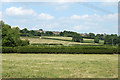
![Tractors in storage [1] in SN10 5TB](https://images.propbar.co.uk/images/geograph/42/73/4273707_120.jpg)
19 photos from this area
Area Information
Key information about the SN10 5TB including its size, population, and administrative classification.
- Area Type
- Postcode
- Area Size
- 74.5 hectares
- Population
- 1485
- Population Density
- 1027 people/km²
House Prices in SN10 5TB
5
Properties
-
Average Sold Price
-
Lowest Price
-
Highest Price
Showing 5 properties
| Address | Type | Beds | Baths | Last Sale Price | Last Sale Date | |
|---|---|---|---|---|---|---|
| Woodlands, Whistley Road, Potterne, SN10 5TB | Detached | - | - | - | - | |
| 5, Lower Park Farm, Whistley Road, Potterne, SN10 5TB | Detached | - | - | - | - | |
| Caen Hill Farm, Whistley Road, Potterne, SN10 5TB | Detached | - | - | - | - | |
| 3, Lower Park Farm, Whistley Road, Potterne, SN10 5TB | Detached | - | - | - | - | |
| North Lower Park Farm, Whistley Road, Potterne, SN10 5TB | Detached | - | - | - | - |
Energy Efficiency in SN10 5TB
Amenities
Schools
| Rank | School | Type | Entry gender | Ages |
|---|
Explore more schools in this area
Go to Schools tabDemographics
Household Size
One person
most common
Accommodation Type
Houses
most common
Tenure
60
majority
Ethnic Group
White
most common
Religion
N/A
most common
Household Composition
N/A
most common
Age
47
median
Adults (30-64 years)
most common
Household Deprivation
N/A
with no deprivation
NS-SEC
30
in Lower managerial occupations
Explore more demographic insights in this area
Go to Demographics tabPlanning
Planning Constraints
- Flood RiskPremium
- Ramsar Wetland SitesPremium
- Area of Outstanding Natural BeautyPremium
- Protected Nature ReservePremium
- Protected WoodlandPremium