Area Overview for SN10 5PR
Photos of SN10 5PR
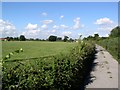
![Footpath leaves the byway [1] in SN10 5PR](https://images.propbar.co.uk/images/geograph/55/73/5573886_120.jpg)
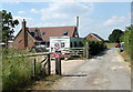

![Five ways to go [3] in SN10 5PR](https://images.propbar.co.uk/images/geograph/52/00/5200689_120.jpg)
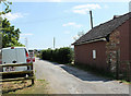
![Five Lanes [1] in SN10 5PR](https://images.propbar.co.uk/images/geograph/52/00/5200698_120.jpg)
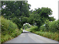
![Five Lanes [2] in SN10 5PR](https://images.propbar.co.uk/images/geograph/52/00/5200701_120.jpg)
![Five Lanes [3] in SN10 5PR](https://images.propbar.co.uk/images/geograph/52/00/5200702_120.jpg)
![Five Lanes [4] in SN10 5PR](https://images.propbar.co.uk/images/geograph/52/00/5200704_120.jpg)
![Five Lanes [5] in SN10 5PR](https://images.propbar.co.uk/images/geograph/52/00/5200706_120.jpg)
17 photos from this area
Area Information
Key information about the SN10 5PR including its size, population, and administrative classification.
- Area Type
- Postcode
- Area Size
- 10.9 hectares
- Population
- 1543
- Population Density
- 124 people/km²
House Prices in SN10 5PR
3
Properties
-
Average Sold Price
-
Lowest Price
-
Highest Price
Showing 3 properties
| Address | Type | Beds | Baths | Last Sale Price | Last Sale Date | |
|---|---|---|---|---|---|---|
| Tennis 75M From Manor Farm House, Worton Road 112M From Worton Road, Worton Road, Potterne, SN10 5PR | Leisure | - | - | - | - | |
| Manor Farm House, Worton Road, Potterne, SN10 5PR | Semi-detached | - | - | - | - | |
| Manor Farm, Worton Road, Potterne, SN10 5PR | house | - | - | - | - |
Energy Efficiency in SN10 5PR
Amenities
Schools
| Rank | School | Type | Entry gender | Ages |
|---|
Explore more schools in this area
Go to Schools tabDemographics
Household Size
Two person
most common
Accommodation Type
Houses
most common
Tenure
69
majority
Ethnic Group
White
most common
Religion
N/A
most common
Household Composition
N/A
most common
Age
47
median
Adults (30-64 years)
most common
Household Deprivation
N/A
with no deprivation
NS-SEC
35
in Lower managerial occupations
Explore more demographic insights in this area
Go to Demographics tabPlanning
Planning Constraints
- Flood RiskPremium
- Ramsar Wetland SitesPremium
- Area of Outstanding Natural BeautyPremium
- Protected Nature ReservePremium
- Protected WoodlandPremium