Area Overview for SN10 5FJ
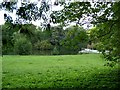
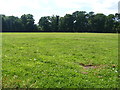
Photos of SN10 5FJ
![Roundway Hospital [2] in SN10 5FJ](https://images.propbar.co.uk/images/geograph/50/57/5057671_120.jpg)
![Roundway Hospital [3] in SN10 5FJ](https://images.propbar.co.uk/images/geograph/50/57/5057674_120.jpg)
![Roundway Hospital [5] in SN10 5FJ](https://images.propbar.co.uk/images/geograph/50/57/5057731_120.jpg)
![Roundway Hospital [6] in SN10 5FJ](https://images.propbar.co.uk/images/geograph/50/57/5057733_120.jpg)
![Roundway Hospital [7] in SN10 5FJ](https://images.propbar.co.uk/images/geograph/50/57/5057734_120.jpg)
![Three ways to go [1] in SN10 5FJ](https://images.propbar.co.uk/images/geograph/50/66/5066992_120.jpg)
![Path meets bridleway [1] in SN10 5FJ](https://images.propbar.co.uk/images/geograph/50/66/5066999_120.jpg)
![Path meets bridleway [2] in SN10 5FJ](https://images.propbar.co.uk/images/geograph/50/67/5067001_120.jpg)


25 photos from this area
Area Information
Key information about the SN10 5FJ including its size, population, and administrative classification.
- Area Type
- Postcode
- Area Size
- 4491 m²
- Population
- 1272
- Population Density
- 1133 people/km²
House Prices in SN10 5FJ
13
Properties
£142,219
Average Sold Price
£100,000
Lowest Price
£180,000
Highest Price
Showing 13 properties
| Address | Type | Beds | Baths | Last Sale Price | Last Sale Date | |
|---|---|---|---|---|---|---|
| 11, Clock Tower Lodge, Thomas Wyatt Road, Devizes, SN10 5FJ | Bungalow | 2 | 1 | £174,000 | Mar 2024 | |
| 14, Clock Tower Lodge, Thomas Wyatt Road, Devizes, SN10 5FJ | Bungalow | 2 | 1 | £180,000 | Aug 2022 | |
| 7, Clock Tower Lodge, Thomas Wyatt Road, Devizes, SN10 5FJ | house | - | - | £163,800 | Jan 2022 | |
| 10, Clock Tower Lodge, Thomas Wyatt Road, Devizes, SN10 5FJ | Bungalow | - | - | £116,000 | Aug 2012 | |
| 9, Clock Tower Lodge, Thomas Wyatt Road, Devizes, SN10 5FJ | Bungalow | - | - | £109,950 | Jul 2012 | |
| 8, Clock Tower Lodge, Thomas Wyatt Road, Devizes, SN10 5FJ | Bungalow | 2 | - | £135,000 | Oct 2009 | |
| 6, Clock Tower Lodge, Thomas Wyatt Road, Devizes, SN10 5FJ | Bungalow | 2 | - | £100,000 | Apr 2009 | |
| 12, Clock Tower Lodge, Thomas Wyatt Road, Devizes, SN10 5FJ | Bungalow | 2 | - | £159,000 | Dec 2006 | |
| 4, Clock Tower Lodge, Thomas Wyatt Road, Devizes, SN10 5FJ | Terraced | 2 | 1 | - | - | |
| 2, Clock Tower Lodge, Thomas Wyatt Road, Devizes, SN10 5FJ | Bungalow | 2 | 1 | - | - |
Page 1 of 2
Energy Efficiency in SN10 5FJ
Amenities
Schools
| Rank | School | Type | Entry gender | Ages |
|---|
Explore more schools in this area
Go to Schools tabDemographics
Household Size
Two person
most common
Accommodation Type
Houses
most common
Tenure
69
majority
Ethnic Group
White
most common
Religion
N/A
most common
Household Composition
N/A
most common
Age
47
median
Adults (30-64 years)
most common
Household Deprivation
N/A
with no deprivation
NS-SEC
41
in Lower managerial occupations
Explore more demographic insights in this area
Go to Demographics tabPlanning
Planning Constraints
- Flood RiskPremium
- Ramsar Wetland SitesPremium
- Area of Outstanding Natural BeautyPremium
- Protected Nature ReservePremium
- Protected WoodlandPremium