Area Overview for SN10 4SH
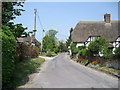
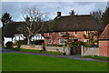
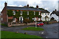
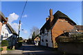
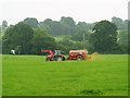
Photos of SN10 4SH
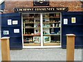
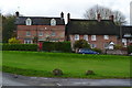
![Across the track [1] in SN10 4SH](https://images.propbar.co.uk/images/geograph/58/21/5821268_120.jpg)
![Across the track [2] in SN10 4SH](https://images.propbar.co.uk/images/geograph/58/21/5821743_120.jpg)
57 photos from this area
Area Information
Key information about the SN10 4SH including its size, population, and administrative classification.
- Area Type
- Postcode
- Area Size
- 2.4 hectares
- Population
- 1939
- Population Density
- 54 people/km²
House Prices in SN10 4SH
28
Properties
£344,298
Average Sold Price
£66,252
Lowest Price
£655,000
Highest Price
Showing 28 properties
| Address | Type | Beds | Baths | Last Sale Price | Last Sale Date | |
|---|---|---|---|---|---|---|
| 6 The Paddock, Urchfont, SN10 4SH | house | - | - | £635,000 | Oct 2025 | |
| 21 The Paddock, Urchfont, SN10 4SH | house | - | - | £260,000 | Aug 2023 | |
| 24 The Paddock, Urchfont, SN10 4SH | Detached | 4 | 2 | £525,000 | Sep 2021 | |
| 9 The Paddock, Urchfont, SN10 4SH | house | - | - | £496,000 | Aug 2021 | |
| 22 The Paddock, Urchfont, SN10 4SH | Detached | 4 | 2 | £435,000 | Nov 2020 | |
| 14 The Paddock, Urchfont, SN10 4SH | house | - | - | £392,000 | Nov 2020 | |
| 23 The Paddock, Urchfont, SN10 4SH | house | - | - | £465,000 | Jul 2019 | |
| 16 The Paddock, Urchfont, SN10 4SH | Semi-detached | 3 | 1 | £260,000 | Mar 2018 | |
| Barton House, The Paddock, Urchfont, SN10 4SH | house | - | - | £655,000 | Jun 2017 | |
| 20 The Paddock, Urchfont, SN10 4SH | house | - | - | £66,252 | Feb 2017 |
Page 1 of 3
Energy Efficiency in SN10 4SH
Amenities
Schools
| Rank | School | Type | Entry gender | Ages |
|---|
Explore more schools in this area
Go to Schools tabDemographics
Household Size
Two person
most common
Accommodation Type
Houses
most common
Tenure
78
majority
Ethnic Group
White
most common
Religion
N/A
most common
Household Composition
N/A
most common
Age
47
median
Adults (30-64 years)
most common
Household Deprivation
N/A
with no deprivation
NS-SEC
42
in Lower managerial occupations
Explore more demographic insights in this area
Go to Demographics tabPlanning
Planning Constraints
- Flood RiskPremium
- Ramsar Wetland SitesPremium
- Area of Outstanding Natural BeautyPremium
- Protected Nature ReservePremium
- Protected WoodlandPremium