Area Overview for SN10 4RT
Photos of SN10 4RT
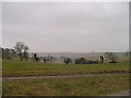
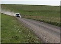
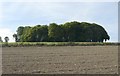
![Towards Urchfont Hill [3] in SN10 4RT](https://images.propbar.co.uk/images/geograph/42/17/4217199_120.jpg)
17 photos from this area
Area Information
Key information about the SN10 4RT including its size, population, and administrative classification.
- Area Type
- Postcode
- Area Size
- 2.4 km²
- Population
- 1939
- Population Density
- 54 people/km²
House Prices in SN10 4RT
40
Properties
£124,250
Average Sold Price
£31,000
Lowest Price
£257,500
Highest Price
Showing 40 properties
| Address | Type | Beds | Baths | Last Sale Price | Last Sale Date | |
|---|---|---|---|---|---|---|
| The Berries, The Croft, Urchfont, SN10 4RT | Bungalow | 3 | 2 | £257,500 | Apr 2024 | |
| 3 The Croft, Urchfont, SN10 4RT | Bungalow | - | - | £150,000 | Oct 2015 | |
| 17 The Croft, Urchfont, SN10 4RT | Flat | - | - | £31,000 | Mar 1996 | |
| 37 The Croft, Urchfont, SN10 4RT | Semi-detached | - | - | £58,500 | Mar 1996 | |
| 33 The Croft, Urchfont, SN10 4RT | Terraced | - | - | - | - | |
| 34 The Croft, Urchfont, SN10 4RT | Bungalow | - | - | - | - | |
| 2 The Croft, Urchfont, SN10 4RT | Bungalow | - | - | - | - | |
| 36 The Croft, Urchfont, SN10 4RT | Semi-detached | - | - | - | - | |
| 14 The Croft, Urchfont, SN10 4RT | Flat | - | - | - | - | |
| 9 The Croft, Urchfont, SN10 4RT | Flat | - | - | - | - |
Page 1 of 4
Energy Efficiency in SN10 4RT
Amenities
Schools
| Rank | School | Type | Entry gender | Ages |
|---|
Explore more schools in this area
Go to Schools tabDemographics
Household Size
Two person
most common
Accommodation Type
Houses
most common
Tenure
78
majority
Ethnic Group
White
most common
Religion
N/A
most common
Household Composition
N/A
most common
Age
47
median
Adults (30-64 years)
most common
Household Deprivation
N/A
with no deprivation
NS-SEC
42
in Lower managerial occupations
Explore more demographic insights in this area
Go to Demographics tabPlanning
Planning Constraints
- Flood RiskPremium
- Ramsar Wetland SitesPremium
- Area of Outstanding Natural BeautyPremium
- Protected Nature ReservePremium
- Protected WoodlandPremium