Area Overview for SN10 4RD
Photos of SN10 4RD
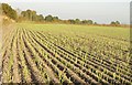
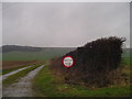
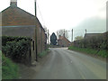
![Towards Urchfont Hill [1] in SN10 4RD](https://images.propbar.co.uk/images/geograph/42/16/4216293_120.jpg)
15 photos from this area
Area Information
Key information about the SN10 4RD including its size, population, and administrative classification.
- Area Type
- Postcode
- Area Size
- 3204 m²
- Population
- 1939
- Population Density
- 54 people/km²
House Prices in SN10 4RD
5
Properties
£245,000
Average Sold Price
£245,000
Lowest Price
£245,000
Highest Price
Showing 5 properties
| Address | Type | Beds | Baths | Last Sale Price | Last Sale Date | |
|---|---|---|---|---|---|---|
| Red Gables, Blackboard Lane, Urchfont, SN10 4RD | Detached | 3 | 1 | £245,000 | Dec 2006 | |
| Hartley House, Blackboard Lane, Urchfont, SN10 4RD | Detached | 5 | - | - | - | |
| Annexe, The Beeches, Blackboard Lane, Urchfont, SN10 4RD | Flat | - | - | - | - | |
| Former The Beeches, Blackboard Lane, Urchfont, SN10 4RD | Detached | - | - | - | - | |
| Three Ways, Blackboard Lane, Urchfont, SN10 4RD | Bungalow | - | - | - | - |
Energy Efficiency in SN10 4RD
Amenities
Schools
| Rank | School | Type | Entry gender | Ages |
|---|
Explore more schools in this area
Go to Schools tabDemographics
Household Size
Two person
most common
Accommodation Type
Houses
most common
Tenure
78
majority
Ethnic Group
White
most common
Religion
N/A
most common
Household Composition
N/A
most common
Age
47
median
Adults (30-64 years)
most common
Household Deprivation
N/A
with no deprivation
NS-SEC
42
in Lower managerial occupations
Explore more demographic insights in this area
Go to Demographics tabPlanning
Planning Constraints
- Flood RiskPremium
- Ramsar Wetland SitesPremium
- Area of Outstanding Natural BeautyPremium
- Protected Nature ReservePremium
- Protected WoodlandPremium