Area Overview for SN10 4PY
Photos of SN10 4PY
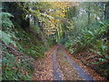
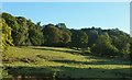
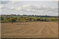
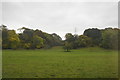
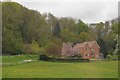
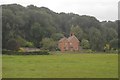
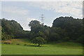
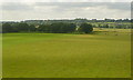
50 photos from this area
Area Information
Key information about the SN10 4PY including its size, population, and administrative classification.
- Area Type
- Postcode
- Area Size
- 1.2 km²
- Population
- 1939
- Population Density
- 54 people/km²
House Prices in SN10 4PY
24
Properties
£777,000
Average Sold Price
£375,000
Lowest Price
£1,179,000
Highest Price
Showing 24 properties
| Address | Type | Beds | Baths | Last Sale Price | Last Sale Date | |
|---|---|---|---|---|---|---|
| Tree Tops, 11 Easterton Sands, Easterton, SN10 4PY | Bungalow | 3 | 1 | £375,000 | Apr 2024 | |
| Fiddington Farm, Easterton Sands, Easterton, SN10 4PY | house | - | - | £1,179,000 | Jul 2023 | |
| 1 Easterton Sands, Easterton, SN10 4PY | Land | - | - | - | - | |
| Orchard House, 6 Easterton Sands, Easterton, SN10 4PY | Land | - | - | - | - | |
| West Wood, 12 Easterton Sands, Easterton, SN10 4PY | house | 4 | - | - | - | |
| SWALLOW COTTAGE, 5B EASTERTON SANDS, Easterton, SN10 4PY | Detached | - | - | - | - | |
| Carers Accommodation, Swallow Cottage, 5B Easterton Sands, Easterton, SN10 4PY | Detached | - | - | - | - | |
| The Annexe, 7 Easterton Sands, Easterton, SN10 4PY | Flat | - | - | - | - | |
| 8 Easterton Sands, Easterton, SN10 4PY | Detached | - | - | - | - | |
| Easterton Vehicles Ltd, 6A Easterton Sands, Easterton, SN10 4PY | Industrial | - | - | - | - |
Page 1 of 3
Energy Efficiency in SN10 4PY
Amenities
Schools
| Rank | School | Type | Entry gender | Ages |
|---|
Explore more schools in this area
Go to Schools tabDemographics
Household Size
Two person
most common
Accommodation Type
Houses
most common
Tenure
78
majority
Ethnic Group
White
most common
Religion
N/A
most common
Household Composition
N/A
most common
Age
47
median
Adults (30-64 years)
most common
Household Deprivation
N/A
with no deprivation
NS-SEC
42
in Lower managerial occupations
Explore more demographic insights in this area
Go to Demographics tabPlanning
Planning Constraints
- Flood RiskPremium
- Ramsar Wetland SitesPremium
- Area of Outstanding Natural BeautyPremium
- Protected Nature ReservePremium
- Protected WoodlandPremium