Area Overview for SN10 3FA
Photos of SN10 3FA
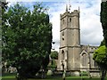
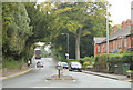
![Devizes buildings [61] in SN10 3FA](https://images.propbar.co.uk/images/geograph/47/64/4764046_120.jpg)
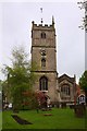
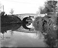
![Kennet and Avon Canal [17] in SN10 3FA](https://images.propbar.co.uk/images/geograph/47/64/4764074_120.jpg)
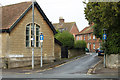
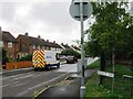
![Devizes buildings [59] in SN10 3FA](https://images.propbar.co.uk/images/geograph/47/64/4764079_120.jpg)
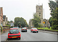
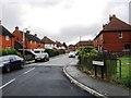
![Devizes features [22] in SN10 3FA](https://images.propbar.co.uk/images/geograph/47/64/4764097_120.jpg)
100 photos from this area
Area Information
Key information about the SN10 3FA including its size, population, and administrative classification.
- Area Type
- Postcode
- Area Size
- 3067 m²
- Population
- 1272
- Population Density
- 1133 people/km²
House Prices in SN10 3FA
10
Properties
£206,085
Average Sold Price
£111,950
Lowest Price
£360,000
Highest Price
Showing 10 properties
| Address | Type | Beds | Baths | Last Sale Price | Last Sale Date | |
|---|---|---|---|---|---|---|
| 3 Kiln Close, Devizes, SN10 3FA | house | 3 | 2 | £360,000 | May 2023 | |
| 9 Kiln Close, Devizes, SN10 3FA | house | - | - | £220,000 | Jul 2019 | |
| 1 Kiln Close, Devizes, SN10 3FA | house | - | - | £325,000 | Oct 2018 | |
| 8 Kiln Close, Devizes, SN10 3FA | Terraced | 3 | - | £207,000 | Sep 2017 | |
| 2 Kiln Close, Devizes, SN10 3FA | Detached | - | - | £220,000 | Jan 2015 | |
| 5 Kiln Close, Devizes, SN10 3FA | house | - | - | £154,950 | Jun 2010 | |
| 4 Kiln Close, Devizes, SN10 3FA | house | - | - | £174,000 | Aug 2009 | |
| 10 Kiln Close, Devizes, SN10 3FA | Detached | - | - | £148,000 | Mar 2002 | |
| 6 Kiln Close, Devizes, SN10 3FA | Semi-detached | 3 | 1 | £111,950 | Dec 2001 | |
| 7 Kiln Close, Devizes, SN10 3FA | Detached | - | - | £139,950 | Dec 2001 |
Energy Efficiency in SN10 3FA
Amenities
Schools
| Rank | School | Type | Entry gender | Ages |
|---|
Explore more schools in this area
Go to Schools tabDemographics
Household Size
Two person
most common
Accommodation Type
Houses
most common
Tenure
69
majority
Ethnic Group
White
most common
Religion
N/A
most common
Household Composition
N/A
most common
Age
47
median
Adults (30-64 years)
most common
Household Deprivation
N/A
with no deprivation
NS-SEC
41
in Lower managerial occupations
Explore more demographic insights in this area
Go to Demographics tabPlanning
Planning Constraints
- Flood RiskPremium
- Ramsar Wetland SitesPremium
- Area of Outstanding Natural BeautyPremium
- Protected Nature ReservePremium
- Protected WoodlandPremium