Area Overview for SN10 2HB
Photos of SN10 2HB
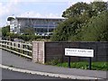
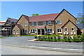
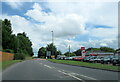
![Hopton Industrial Estate [5] in SN10 2HB](https://images.propbar.co.uk/images/geograph/42/45/4245589_120.jpg)
22 photos from this area
Area Information
Key information about the SN10 2HB including its size, population, and administrative classification.
- Area Type
- Postcode
- Area Size
- 7084 m²
- Population
- 1821
- Population Density
- 347 people/km²
House Prices in SN10 2HB
8
Properties
£165,333
Average Sold Price
£47,000
Lowest Price
£350,000
Highest Price
Showing 8 properties
| Address | Type | Beds | Baths | Last Sale Price | Last Sale Date | |
|---|---|---|---|---|---|---|
| 2, Cross Roads, London Road, Devizes, SN10 2HB | house | - | - | £350,000 | Jun 2018 | |
| 6, Cross Roads, London Road, Devizes, SN10 2HB | house | - | - | £215,000 | Jul 2007 | |
| 7, Cross Roads, London Road, Devizes, SN10 2HB | Semi-detached | - | - | £156,000 | Oct 2006 | |
| 4, Cross Roads, London Road, Devizes, SN10 2HB | Terraced | 3 | 1 | £134,000 | Jun 2004 | |
| 3, Cross Roads, London Road, Devizes, SN10 2HB | Terraced | - | - | £90,000 | Sep 1999 | |
| 8, Cross Roads, London Road, Devizes, SN10 2HB | Semi-detached | - | - | £47,000 | Jan 1996 | |
| 1, Cross Roads, London Road, Devizes, SN10 2HB | Semi-detached | - | - | - | - | |
| 5, Cross Roads, London Road, Devizes, SN10 2HB | Terraced | - | - | - | - |
Energy Efficiency in SN10 2HB
Amenities
Schools
| Rank | School | Type | Entry gender | Ages |
|---|
Explore more schools in this area
Go to Schools tabDemographics
Household Size
Two person
most common
Accommodation Type
Houses
most common
Tenure
65
majority
Ethnic Group
White
most common
Religion
N/A
most common
Household Composition
N/A
most common
Age
47
median
Adults (30-64 years)
most common
Household Deprivation
N/A
with no deprivation
NS-SEC
37
in Lower managerial occupations
Explore more demographic insights in this area
Go to Demographics tabPlanning
Planning Constraints
- Flood RiskPremium
- Ramsar Wetland SitesPremium
- Area of Outstanding Natural BeautyPremium
- Protected Nature ReservePremium
- Protected WoodlandPremium