Area Overview for SN10 1SD
Photos of SN10 1SD


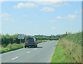
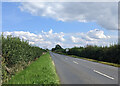
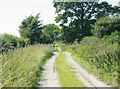
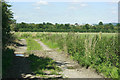
6 photos from this area
Area Information
Key information about the SN10 1SD including its size, population, and administrative classification.
- Area Type
- Postcode
- Area Size
- 1.2 km²
- Population
- 1509
- Population Density
- 85 people/km²
House Prices in SN10 1SD
14
Properties
£407,500
Average Sold Price
£365,000
Lowest Price
£450,000
Highest Price
Showing 14 properties
| Address | Type | Beds | Baths | Last Sale Price | Last Sale Date | |
|---|---|---|---|---|---|---|
| Townsend Cottage, 29 Townsend, Poulshot, SN10 1SD | house | - | - | £450,000 | May 2013 | |
| White Bungalow, 2 Townsend, Poulshot, SN10 1SD | Bungalow | 4 | 2 | £365,000 | Jul 2006 | |
| Annexe, Townsend Farmhouse, Townsend, Poulshot, SN10 1SD | house | 2 | 1 | - | - | |
| Annexe, Townsend Barn, 15 Townsend, Poulshot, SN10 1SD | Flat | - | - | - | - | |
| Ivy Design, Unit 1, Townsend Court, Townsend, Poulshot, SN10 1SD | Office | - | - | - | - | |
| The Stables, Townsend, Poulshot, SN10 1SD | undefined | - | - | - | - | |
| Townsend Farm, Townsend, Poulshot, SN10 1SD | Detached | - | - | - | - | |
| Tennis 88M From 35 Townsend 81M From Poulshot Road, Townsend, Poulshot, SN10 1SD | Leisure | - | - | - | - | |
| 35A Townsend, Poulshot, SN10 1SD | house | - | - | - | - | |
| Workshop, Townsend Farmhouse, Townsend, Poulshot, SN10 1SD | Industrial | - | - | - | - |
Page 1 of 2
Energy Efficiency in SN10 1SD
Amenities
Schools
| Rank | School | Type | Entry gender | Ages |
|---|
Explore more schools in this area
Go to Schools tabDemographics
Household Size
Two person
most common
Accommodation Type
Houses
most common
Tenure
77
majority
Ethnic Group
White
most common
Religion
N/A
most common
Household Composition
N/A
most common
Age
47
median
Adults (30-64 years)
most common
Household Deprivation
N/A
with no deprivation
NS-SEC
40
in Lower managerial occupations
Explore more demographic insights in this area
Go to Demographics tabPlanning
Planning Constraints
- Flood RiskPremium
- Ramsar Wetland SitesPremium
- Area of Outstanding Natural BeautyPremium
- Protected Nature ReservePremium
- Protected WoodlandPremium