Area Overview for SN10 1QE
Photos of SN10 1QE
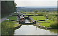
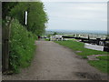
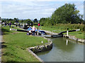
![Looking down [nearly all] the Caen Hill flight in SN10 1QE](https://images.propbar.co.uk/images/geograph/44/93/4493941_120.jpg)
100 photos from this area
Area Information
Key information about the SN10 1QE including its size, population, and administrative classification.
- Area Type
- Postcode
- Area Size
- 8807 m²
- Population
- 1485
- Population Density
- 1027 people/km²
House Prices in SN10 1QE
11
Properties
£223,357
Average Sold Price
£50,000
Lowest Price
£357,500
Highest Price
Showing 11 properties
| Address | Type | Beds | Baths | Last Sale Price | Last Sale Date | |
|---|---|---|---|---|---|---|
| Arrow Brook, Bath Road, Devizes, SN10 1QE | house | - | - | £305,000 | Apr 2015 | |
| Littledean, Bath Road, Devizes, SN10 1QE | house | - | - | £357,500 | Aug 2013 | |
| Ryelands, Bath Road, Devizes, SN10 1QE | house | - | - | £250,000 | Jan 2012 | |
| Lungla, Bath Road, Devizes, SN10 1QE | house | - | - | £290,000 | Sep 2011 | |
| Dindigul, Bath Road, Devizes, SN10 1QE | Terraced | - | - | £212,500 | Jun 2006 | |
| 3, Claremont Villas, Bath Road, Devizes, SN10 1QE | house | - | - | £98,500 | Apr 2002 | |
| 2, Claremont Villas, Bath Road, Devizes, SN10 1QE | Terraced | 2 | - | £50,000 | Jun 1999 | |
| Melstock, Bath Road, Devizes, SN10 1QE | Terraced | - | - | - | - | |
| Linden Lea, Bath Road, Devizes, SN10 1QE | Terraced | - | - | - | - | |
| 1, Claremont Villas, Bath Road, Devizes, SN10 1QE | Terraced | - | - | - | - |
Page 1 of 2
Energy Efficiency in SN10 1QE
Amenities
Schools
| Rank | School | Type | Entry gender | Ages |
|---|
Explore more schools in this area
Go to Schools tabDemographics
Household Size
One person
most common
Accommodation Type
Houses
most common
Tenure
60
majority
Ethnic Group
White
most common
Religion
N/A
most common
Household Composition
N/A
most common
Age
47
median
Adults (30-64 years)
most common
Household Deprivation
N/A
with no deprivation
NS-SEC
30
in Lower managerial occupations
Explore more demographic insights in this area
Go to Demographics tabPlanning
Planning Constraints
- Flood RiskPremium
- Ramsar Wetland SitesPremium
- Area of Outstanding Natural BeautyPremium
- Protected Nature ReservePremium
- Protected WoodlandPremium