Area Overview for SN10 1PH
Photos of SN10 1PH
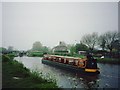
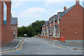
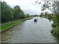
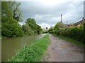
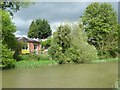
100 photos from this area
Area Information
Key information about the SN10 1PH including its size, population, and administrative classification.
- Area Type
- Postcode
- Area Size
- 6144 m²
- Population
- 1485
- Population Density
- 1027 people/km²
House Prices in SN10 1PH
12
Properties
£250,615
Average Sold Price
£77,500
Lowest Price
£557,000
Highest Price
Showing 12 properties
| Address | Type | Beds | Baths | Last Sale Price | Last Sale Date | |
|---|---|---|---|---|---|---|
| Wren House, Bath Road, Devizes, SN10 1PH | Bungalow | - | - | £557,000 | Jul 2022 | |
| 18, Avon View, Bath Road, Devizes, SN10 1PH | Semi-detached | 3 | 1 | £235,150 | Dec 2021 | |
| 17, Avon View, Bath Road, Devizes, SN10 1PH | house | - | - | £178,000 | Feb 2021 | |
| 13, Avon View, Bath Road, Devizes, SN10 1PH | Semi-detached | 3 | 2 | £232,000 | Mar 2019 | |
| 14, Avon View, Bath Road, Devizes, SN10 1PH | Semi-detached | 3 | - | £199,000 | Aug 2015 | |
| Grangemead, Bath Road, Devizes, SN10 1PH | Detached | - | - | £365,000 | Apr 2007 | |
| 16, Avon View, Bath Road, Devizes, SN10 1PH | Semi-detached | - | - | £191,000 | Nov 2006 | |
| Hunters Moon, Bath Road, Devizes, SN10 1PH | Detached | - | - | £245,000 | Jan 2005 | |
| Bengal, Bath Road, Devizes, SN10 1PH | Detached | - | - | £226,500 | Dec 2004 | |
| 15, Avon View, Bath Road, Devizes, SN10 1PH | Semi-detached | 3 | - | £77,500 | Sep 1999 |
Page 1 of 2
Energy Efficiency in SN10 1PH
Amenities
Schools
| Rank | School | Type | Entry gender | Ages |
|---|
Explore more schools in this area
Go to Schools tabDemographics
Household Size
One person
most common
Accommodation Type
Houses
most common
Tenure
60
majority
Ethnic Group
White
most common
Religion
N/A
most common
Household Composition
N/A
most common
Age
47
median
Adults (30-64 years)
most common
Household Deprivation
N/A
with no deprivation
NS-SEC
30
in Lower managerial occupations
Explore more demographic insights in this area
Go to Demographics tabPlanning
Planning Constraints
- Flood RiskPremium
- Ramsar Wetland SitesPremium
- Area of Outstanding Natural BeautyPremium
- Protected Nature ReservePremium
- Protected WoodlandPremium