Area Overview for SN1 5PL
Photos of SN1 5PL
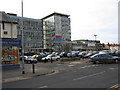
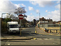
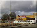
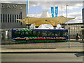
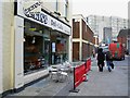
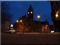
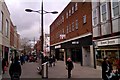
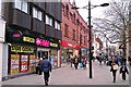

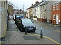

100 photos from this area
Area Information
Key information about the SN1 5PL including its size, population, and administrative classification.
- Area Type
- Postcode
- Area Size
- 8111 m²
- Population
- 1872
- Population Density
- 12555 people/km²
House Prices in SN1 5PL
47
Properties
£95,131
Average Sold Price
£85,196
Lowest Price
£115,000
Highest Price
Showing 47 properties
| Address | Type | Beds | Baths | Last Sale Price | Last Sale Date | |
|---|---|---|---|---|---|---|
| Flat 11, 103 Commercial Road, Swindon, SN1 5PL | Flat | 1 | 1 | £115,000 | Nov 2020 | |
| 106A, 106 Commercial Road, Swindon, SN1 5PL | Maisonette | - | - | £85,196 | Jul 2018 | |
| 105A, 105 Commercial Road, Swindon, SN1 5PL | Flat | - | - | £85,196 | Jul 2018 | |
| First Floor, 101 Commercial Road, Swindon, SN1 5PL | Land | 2 | - | - | - | |
| Flat, 96-97 Commercial Road, Swindon, SN1 5PL | Flat | 3 | - | - | - | |
| Flat A, 100 Commercial Road, Swindon, SN1 5PL | Flat | - | - | - | - | |
| 112 Commercial Road, Swindon, SN1 5PL | shop | - | - | - | - | |
| Polski Sklep, 111, 109-114 Commercial Road, Swindon, SN1 5PL | shop | - | - | - | - | |
| Adshel 49040294, Commercial Road, Swindon, SN1 5PL | Industrial | - | - | - | - | |
| Unit 4, Anglia House, 115-118 Commercial Road, Swindon, SN1 5PL | Office | - | - | - | - |
Page 1 of 5
Energy Efficiency in SN1 5PL
Amenities
Schools
| Rank | School | Type | Entry gender | Ages |
|---|
Explore more schools in this area
Go to Schools tabDemographics
Household Size
One person
most common
Accommodation Type
Houses
most common
Tenure
49
majority
Ethnic Group
White
most common
Religion
N/A
most common
Household Composition
N/A
most common
Age
47
median
Adults (30-64 years)
most common
Household Deprivation
N/A
with no deprivation
NS-SEC
35
in Lower managerial occupations
Explore more demographic insights in this area
Go to Demographics tabPlanning
Planning Constraints
- Flood RiskPremium
- Ramsar Wetland SitesPremium
- Area of Outstanding Natural BeautyPremium
- Protected Nature ReservePremium
- Protected WoodlandPremium