Area Overview for SN1 3BD
Photos of SN1 3BD
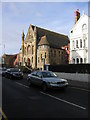
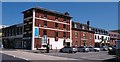


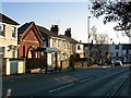
100 photos from this area
Area Information
Key information about the SN1 3BD including its size, population, and administrative classification.
- Area Type
- Postcode
- Area Size
- 5098 m²
- Population
- 1232
- Population Density
- 7643 people/km²
House Prices in SN1 3BD
20
Properties
£219,250
Average Sold Price
£107,000
Lowest Price
£400,000
Highest Price
Showing 20 properties
| Address | Type | Beds | Baths | Last Sale Price | Last Sale Date | |
|---|---|---|---|---|---|---|
| GROUND FLOOR, 97-98 VICTORIA ROAD, Old Town, Swindon, SN1 3BD | Flat | 2 | - | £400,000 | Mar 2023 | |
| 95A, 95 VICTORIA ROAD, Old Town, Swindon, SN1 3BD | Flat | 2 | 1 | £230,000 | May 2022 | |
| 94A, 94 Victoria Road, Old Town, Swindon, SN1 3BD | Flat | 2 | 1 | £107,000 | Mar 2016 | |
| 102A Victoria Road, Old Town, Swindon, SN1 3BD | Flat | - | - | £140,000 | May 2015 | |
| Arabian Nights, 94 Victoria Road, Old Town, Swindon, SN1 3BD | Retail | - | - | - | - | |
| Flat A, 93 Victoria Road, Old Town, Swindon, SN1 3BD | Flat | - | - | - | - | |
| 97 Victoria Road, Old Town, Swindon, SN1 3BD | Office | - | - | - | - | |
| The Victoria Public House, The Victoria, 88 Victoria Road, Old Town, Swindon, SN1 3BD | restaurant_cafe | - | - | - | - | |
| Prospect Hospice Shop, 98 Victoria Road, Old Town, Swindon, SN1 3BD | shop | - | - | - | - | |
| Ruchi, 89 Victoria Road, Old Town, Swindon, SN1 3BD | restaurant_cafe | - | - | - | - |
Page 1 of 2
Energy Efficiency in SN1 3BD
Amenities
Schools
| Rank | School | Type | Entry gender | Ages |
|---|
Explore more schools in this area
Go to Schools tabDemographics
Household Size
One person
most common
Accommodation Type
Houses
most common
Tenure
36
majority
Ethnic Group
White
most common
Religion
N/A
most common
Household Composition
N/A
most common
Age
47
median
Adults (30-64 years)
most common
Household Deprivation
N/A
with no deprivation
NS-SEC
37
in Lower managerial occupations
Explore more demographic insights in this area
Go to Demographics tabPlanning
Planning Constraints
- Flood RiskPremium
- Ramsar Wetland SitesPremium
- Area of Outstanding Natural BeautyPremium
- Protected Nature ReservePremium
- Protected WoodlandPremium