Area Overview for SN1 3AQ
Photos of SN1 3AQ
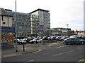
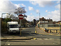


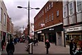


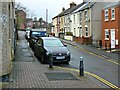

100 photos from this area
Area Information
Key information about the SN1 3AQ including its size, population, and administrative classification.
- Area Type
- Postcode
- Area Size
- 1.1 hectares
- Population
- 1593
- Population Density
- 3833 people/km²
House Prices in SN1 3AQ
16
Properties
£221,625
Average Sold Price
£73,000
Lowest Price
£401,500
Highest Price
Showing 16 properties
| Address | Type | Beds | Baths | Last Sale Price | Last Sale Date | |
|---|---|---|---|---|---|---|
| 143 Drove Road, Swindon, SN1 3AQ | Detached | 3 | 2 | £401,500 | Aug 2022 | |
| 171 Drove Road, Swindon, SN1 3AQ | Semi-detached | 3 | 1 | £295,000 | Aug 2018 | |
| 149 Drove Road, Swindon, SN1 3AQ | house | 3 | 2 | £235,000 | Dec 2015 | |
| 173 Drove Road, Swindon, SN1 3AQ | Detached | 3 | - | £213,500 | Feb 2015 | |
| 159 Drove Road, Swindon, SN1 3AQ | Detached | - | - | £210,000 | Apr 2007 | |
| 163 Drove Road, Swindon, SN1 3AQ | house | - | - | £175,000 | Aug 2006 | |
| 153 Drove Road, Swindon, SN1 3AQ | house | - | - | £170,000 | Jan 2006 | |
| 165 Drove Road, Swindon, SN1 3AQ | Semi-detached | 3 | 1 | £73,000 | Nov 1996 | |
| 157 Drove Road, Swindon, SN1 3AQ | house | - | - | - | - | |
| 169 Drove Road, Swindon, SN1 3AQ | Semi-detached | - | - | - | - |
Page 1 of 2
Energy Efficiency in SN1 3AQ
Amenities
Schools
| Rank | School | Type | Entry gender | Ages |
|---|
Explore more schools in this area
Go to Schools tabDemographics
Household Size
Two person
most common
Accommodation Type
Houses
most common
Tenure
82
majority
Ethnic Group
White
most common
Religion
N/A
most common
Household Composition
N/A
most common
Age
47
median
Adults (30-64 years)
most common
Household Deprivation
N/A
with no deprivation
NS-SEC
35
in Lower managerial occupations
Explore more demographic insights in this area
Go to Demographics tabPlanning
Planning Constraints
- Flood RiskPremium
- Ramsar Wetland SitesPremium
- Area of Outstanding Natural BeautyPremium
- Protected Nature ReservePremium
- Protected WoodlandPremium