Area Overview for SN1 2LG
Photos of SN1 2LG
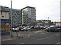
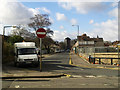


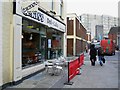
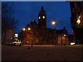
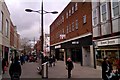
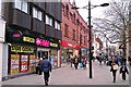

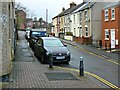

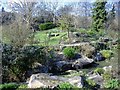
100 photos from this area
Area Information
Key information about the SN1 2LG including its size, population, and administrative classification.
- Area Type
- Postcode
- Area Size
- 5160 m²
- Population
- 2228
- Population Density
- 7295 people/km²
House Prices in SN1 2LG
26
Properties
£134,369
Average Sold Price
£38,000
Lowest Price
£242,000
Highest Price
Showing 26 properties
| Address | Type | Beds | Baths | Last Sale Price | Last Sale Date | |
|---|---|---|---|---|---|---|
| 77 Newcastle Street, Swindon, SN1 2LG | Terraced | 2 | 1 | £240,000 | Feb 2025 | |
| 75 Newcastle Street, Swindon, SN1 2LG | Retail | 2 | 1 | £242,000 | Oct 2022 | |
| 73 Newcastle Street, Swindon, SN1 2LG | house | - | - | £177,500 | May 2022 | |
| 70 Newcastle Street, Swindon, SN1 2LG | house | - | - | £170,000 | Oct 2020 | |
| 69 Newcastle Street, Swindon, SN1 2LG | Terraced | 2 | 1 | £184,000 | Jun 2019 | |
| 58 Newcastle Street, Swindon, SN1 2LG | Terraced | 2 | 2 | £202,000 | Jun 2018 | |
| 66 Newcastle Street, Swindon, SN1 2LG | house | - | - | £180,000 | Jun 2017 | |
| 76 Newcastle Street, Swindon, SN1 2LG | Terraced | 3 | 1 | £208,000 | Mar 2017 | |
| 68 Newcastle Street, Swindon, SN1 2LG | Terraced | 2 | 2 | £132,000 | Mar 2014 | |
| 59 Newcastle Street, Swindon, SN1 2LG | house | 2 | 1 | £119,000 | Jul 2013 |
Page 1 of 3
Energy Efficiency in SN1 2LG
Amenities
Schools
| Rank | School | Type | Entry gender | Ages |
|---|
Explore more schools in this area
Go to Schools tabDemographics
Household Size
Family (3-5 people)
most common
Accommodation Type
Houses
most common
Tenure
63
majority
Ethnic Group
asian_total
most common
Religion
N/A
most common
Household Composition
N/A
most common
Age
47
median
Adults (30-64 years)
most common
Household Deprivation
N/A
with no deprivation
NS-SEC
25
in Lower managerial occupations
Explore more demographic insights in this area
Go to Demographics tabPlanning
Planning Constraints
- Flood RiskPremium
- Ramsar Wetland SitesPremium
- Area of Outstanding Natural BeautyPremium
- Protected Nature ReservePremium
- Protected WoodlandPremium