Area Overview for SN1 2AU
Photos of SN1 2AU
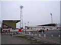
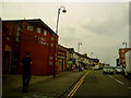
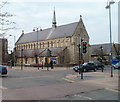
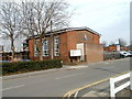
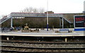

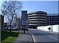
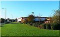
100 photos from this area
Area Information
Key information about the SN1 2AU including its size, population, and administrative classification.
- Area Type
- Postcode
- Area Size
- 3829 m²
- Population
- 2472
- Population Density
- 12226 people/km²
House Prices in SN1 2AU
17
Properties
£138,412
Average Sold Price
£108,000
Lowest Price
£195,000
Highest Price
Showing 17 properties
| Address | Type | Beds | Baths | Last Sale Price | Last Sale Date | |
|---|---|---|---|---|---|---|
| 80 Gladstone Street, Swindon, SN1 2AU | house | - | - | £195,000 | Dec 2025 | |
| 84 Gladstone Street, Swindon, SN1 2AU | Terraced | 3 | 1 | £180,000 | Jan 2020 | |
| 78 Gladstone Street, Swindon, SN1 2AU | Terraced | 2 | 1 | £169,950 | Mar 2017 | |
| 74 Gladstone Street, Swindon, SN1 2AU | house | 2 | 1 | £155,500 | Jul 2016 | |
| 72 Gladstone Street, Swindon, SN1 2AU | house | - | - | £125,000 | Feb 2016 | |
| 71 Gladstone Street, Swindon, SN1 2AU | house | - | - | £136,000 | Jul 2007 | |
| 81 Gladstone Street, Swindon, SN1 2AU | house | - | - | £134,000 | Apr 2007 | |
| 75 Gladstone Street, Swindon, SN1 2AU | house | - | - | £115,000 | Jul 2005 | |
| 79 Gladstone Street, Swindon, SN1 2AU | house | - | - | £115,500 | Feb 2005 | |
| 77 Gladstone Street, Swindon, SN1 2AU | Terraced | - | - | £111,999 | Dec 2004 |
Page 1 of 2
Energy Efficiency in SN1 2AU
Amenities
Schools
| Rank | School | Type | Entry gender | Ages |
|---|
Explore more schools in this area
Go to Schools tabDemographics
Household Size
Family (3-5 people)
most common
Accommodation Type
Houses
most common
Tenure
53
majority
Ethnic Group
asian_total
most common
Religion
N/A
most common
Household Composition
N/A
most common
Age
47
median
Adults (30-64 years)
most common
Household Deprivation
N/A
with no deprivation
NS-SEC
11
in Lower managerial occupations
Explore more demographic insights in this area
Go to Demographics tabPlanning
Planning Constraints
- Flood RiskPremium
- Ramsar Wetland SitesPremium
- Area of Outstanding Natural BeautyPremium
- Protected Nature ReservePremium
- Protected WoodlandPremium