Area Overview for SN1 1DH
Photos of SN1 1DH
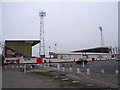
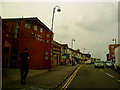
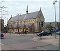

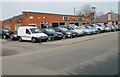
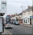

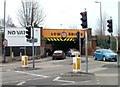
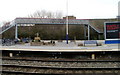

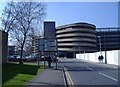
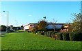
100 photos from this area
Area Information
Key information about the SN1 1DH including its size, population, and administrative classification.
- Area Type
- Postcode
- Area Size
- 9258 m²
- Population
- 1737
- Population Density
- 9319 people/km²
House Prices in SN1 1DH
29
Properties
£133,061
Average Sold Price
£38,000
Lowest Price
£250,000
Highest Price
Showing 29 properties
| Address | Type | Beds | Baths | Last Sale Price | Last Sale Date | |
|---|---|---|---|---|---|---|
| 51 Station Road, Swindon, SN1 1DH | Terraced | 3 | 1 | £250,000 | Jun 2025 | |
| 55 Station Road, Swindon, SN1 1DH | Terraced | 3 | 1 | £223,000 | Feb 2023 | |
| 56 Station Road, Swindon, SN1 1DH | Terraced | 3 | 2 | £245,000 | Oct 2022 | |
| 64 Station Road, Swindon, SN1 1DH | Terraced | 3 | 1 | £170,000 | Feb 2021 | |
| 59 Station Road, Swindon, SN1 1DH | Terraced | 3 | 1 | £198,500 | May 2018 | |
| 67 Station Road, Swindon, SN1 1DH | Terraced | 3 | 1 | £162,000 | Mar 2017 | |
| 65 Station Road, Swindon, SN1 1DH | Terraced | 3 | - | £148,000 | Jul 2016 | |
| 48 Station Road, Swindon, SN1 1DH | Terraced | 2 | 2 | £115,000 | Jan 2015 | |
| 60 Station Road, Swindon, SN1 1DH | house | 3 | 2 | £130,000 | Nov 2013 | |
| 57 Station Road, Swindon, SN1 1DH | house | - | - | £112,000 | Oct 2012 |
Page 1 of 3
Energy Efficiency in SN1 1DH
Amenities
Schools
| Rank | School | Type | Entry gender | Ages |
|---|
Explore more schools in this area
Go to Schools tabDemographics
Household Size
One person
most common
Accommodation Type
Flats
most common
Tenure
14
majority
Ethnic Group
asian_total
most common
Religion
N/A
most common
Household Composition
N/A
most common
Age
47
median
Adults (30-64 years)
most common
Household Deprivation
N/A
with no deprivation
NS-SEC
28
in Lower managerial occupations
Explore more demographic insights in this area
Go to Demographics tabPlanning
Planning Constraints
- Flood RiskPremium
- Ramsar Wetland SitesPremium
- Area of Outstanding Natural BeautyPremium
- Protected Nature ReservePremium
- Protected WoodlandPremium