Area Overview for Redland Ward
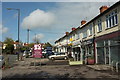
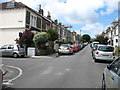
Photos of Redland Ward
Area Information
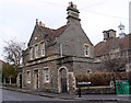
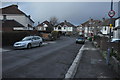
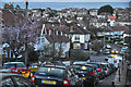
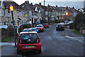
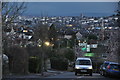
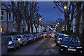
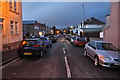
Redland Ward occupies a distinct 1.7 square kilometres in the north of Bristol, housing a population of 1,433 residents. This small but defined district lies between Clifton, Cotham, Bishopston and Westbury Park, forming part of the unitary authority of Bristol. The area was incorporated into the city's boundaries in 1835 and became a separate civil parish in 1894. Historically, the name traces back to the English phrase 'Red Land,' referring to the red soil found here since the 13th century. Over centuries, it evolved from rural farmland owned by the Canons of Westbury College into a Victorian suburb by 1900. Today, life in Redland Ward centres around key landmarks like Redland Green, a public open space expanded between 1902 and 1956 from former allotments. Historical significance permeates the streets, with Grade I listed heritage such as Redland Chapel, built in 1742, and Redland Court, which now forms part of Redland High School. The ward sits at coordinates 51.47154, -2.597437, creating a residential environment defined by its picturesque Victorian houses and leafy atmosphere. Residents here enjoy a established community feel within a compact geographical footprint that balances historical prestige with modern suburban convenience.
- Area Type
- District Borough Unitary Ward
- Area Size
- 1.7 km²
- Population
- 1433
- Population Density
- 827 people/km²
Demographics
The community in Redland Ward is characterised by a very mature population profile. The data indicates a median age of 70 years, making it one of the oldest areas in Bristol. While the provided statistics label the most common age range simply as 'Age: Total', the high median suggests the ward caters primarily to retirees and established families rather than young professionals or students. Home ownership is widespread, with 64% of households owning their properties outright or with a mortgage. This high rate of ownership reflects the stable nature of the resident base. Regarding accommodation and diversity, the available data aggregates household composition, accommodation types, predominant ethnic groups, and religious affiliations into single summary categories without further breakdown. Consequently, specific details on the mix of families versus singles, or exact ethnic breakdowns, are not granularly available in this dataset. However, the general character of the ward is described as affluent and middle-class, resulting from its transformation from farmland into a Victorian neighbourhood. The low population density relative to other Bristol suburbs, combined with the age profile, points to a quiet residential zone where daily life revolves around local amenities and community spaces rather than high-energy nightlife or student housing clusters.
Household Size
Accommodation Type
Tenure
Ethnic Group
Religion
Household Composition
Age
Household Deprivation
NS-SEC
Explore more demographic insights in this area
Go to Demographics tabPlanning
Planning Constraints
- Flood RiskPremium
- Ramsar Wetland SitesPremium
- Area of Outstanding Natural BeautyPremium
- Protected Nature ReservePremium
- Protected WoodlandPremium