Area Overview for Priston
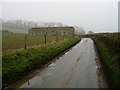
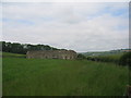
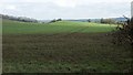
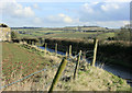
Photos of Priston


Area Information
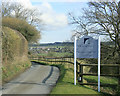
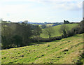
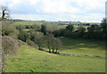
Priston is a compact civil parish in England covering just 7.5 square kilometres. This small footprint creates a tight-knit environment where residents know their neighbours and practical distances for local errands. The majority of people living in Priston are older adults, with a community median age of seventy years. This demographic shapes a quiet, established atmosphere focused on family life and retirement rather than rapid urban development. Homes in Priston reflect this settled character, prioritising stability over trends. You will find a neighbourhood designed for slower living, where the pace matches the age of those calling it home. Daily life involves close proximity to established local amenities rather than long commutes to distant city centres. The area offers a sense of permanence that appeals to buyers seeking a quiet escape from the rush of larger towns. Living in Priston means embracing a environment defined by history, community ownership, and a reduced reliance on major highways. The physical scale of the parish ensures that walking or cycling often covers most daily needs without leaving the locality.
- Area Type
- Parish
- Area Size
- 7.5 km²
- Population
- Not available
- Population Density
- Not available
Demographics
The community in Priston reflects a mature population settled for the long term. A median age of seventy years suggests that the village centre and surrounding lanes cater primarily to retirees and older families. High home ownership levels of 67% confirm that most residents have lived here for decades, building equity rather than renting short-term stays. This figure is significantly above the national average, indicating a very stable social fabric among homes in Priston. Household composition leans towards single-occupancy or couple-only units, mirroring the age demographics of the area. There is no indication of high turnover rates or transient populations within the parish boundaries. The predominantly older population means local shops and services likely prioritise convenience and regular routines over trend-driven retail changes. For anyone considering moving to Priston, the demographic profile signals a region where tradition and stability take precedence. The age structure also implies that family businesses or community groups may be led by long-standing local residents familiar with the history of the parish. This continuity creates a supportive network for new arrivals seeking to understand the local customs and expectations.
Household Size
Accommodation Type
Tenure
Ethnic Group
Religion
Household Composition
Age
Household Deprivation
NS-SEC
Explore more demographic insights in this area
Go to Demographics tabPlanning
Planning Constraints
- Flood RiskPremium
- Ramsar Wetland SitesPremium
- Area of Outstanding Natural BeautyPremium
- Protected Nature ReservePremium
- Protected WoodlandPremium
- Crime RiskPremium