Area Overview for Plympton Chaddlewood Ward
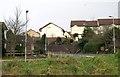
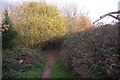
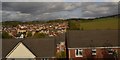
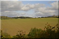
Photos of Plympton Chaddlewood Ward

Area Information
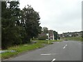
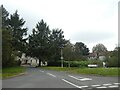
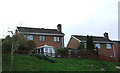
Plympton Chaddlewood Ward is a compact district covering just 1.5 km², yet it offers a distinct character within the wider borough. This ward sits at the intersection of urban convenience and local community life, where daily routines are shaped by its small footprint. You will find a neighbourhood where residents benefit from direct access to local amenities without needing to travel far. The area's size encourages a sense of familiarity among long-term inhabitants, while its location provides easy links to the larger centres of the region. Living in Plympton Chaddlewood Ward means choosing a specific slice of Devon that balances proximity to services with a relatively quiet residential environment. The ward does not attempt to hide behind grand claims; instead, it presents a straightforward picture of a functional catchment area. Prospective buyers here seek stability and know exactly what they are acquiring. The tight geographical boundaries mean that news and events travel quickly within the community. Anyone considering homes in Plympton Chaddlewood Ward should understand that this is a microcosm of local living, where the edges of your garden may be close to a playground or a park. The simplicity of the area's layout is its primary advantage, removing the complexity often found in larger urban districts.
- Area Type
- District Borough Unitary Ward
- Area Size
- 1.5 km²
- Population
- Not available
- Population Density
- Not available
Demographics
The community in Plympton Chaddlewood Ward displays a clear demographic profile that defines its daily rhythm. The median age of the population is 70, indicating a neighbourhood where older generations form the core of residential life. This age structure suggests a community built on stability, with many residents having lived here for decades. Most households are owner-occupied, with a home ownership rate of 72%. This high figure reflects a desire for permanence rather than short-term renting. The absence of data regarding specific household composition types or predominant ethnic groups means we must focus on what is evident: a settled, older population. The lack of statistical detail on religion or specific ethnic breakdowns suggests a homogenous or stable local demographic rather than a rapidly changing one. Living in this ward involves engaging with neighbours who have likely known each other for a long time. You are entering an environment where families and retirees have put down roots. The absence of younger age groups in the available statistics may mean fewer school-aged children locally, though schools near Plympton Chaddlewood Ward remain a key consideration for those commuting into the area. The 72% home ownership figure stands as a definitive marker of this neighbourhood's character, distinguishing it from flashier, rental-heavy urban spots.
Household Size
Accommodation Type
Tenure
Ethnic Group
Religion
Household Composition
Age
Household Deprivation
NS-SEC
Explore more demographic insights in this area
Go to Demographics tabPlanning
Planning Constraints
- Flood RiskPremium
- Ramsar Wetland SitesPremium
- Area of Outstanding Natural BeautyPremium
- Protected Nature ReservePremium
- Crime RiskPremium