Area Overview for Plymouth
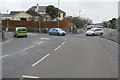
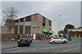
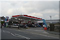
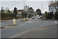
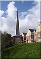
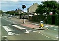
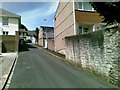
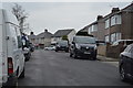
BP Garage, Compton in Plymouth
Lower Compton Park in Plymouth
Eggbuckland Rd, Efford Rd junction in Plymouth
The Co-operative, Higher Compton in Plymouth
ESSO filling station, Higher Compton in Plymouth
Eggbuckland Rd, Higher Compton Rd junction in Plymouth
Colourful shed, Trefusis Gardens in Plymouth
Spire Court, Plymouth in Plymouth
Priory Road, Compton in Plymouth
Eggbuckland Road, Plymouth in Plymouth
Byland Road, Plymouth in Plymouth
Hollycroft Rd in Plymouth
24 photos from this area

Area Information

Plymouth is a built-up area in England covering 59.3 km², home to 89,040 residents. With a population density of 1,500 people per square kilometre, it is a compact, urban environment where daily life is shaped by proximity to amenities and transport. The city blends historical architecture with modern infrastructure, offering a mix of residential, commercial, and recreational spaces. Its strategic location on the south coast provides access to coastal views, ferry routes, and nearby airports. Residents benefit from a well-connected transport network, including rail stations, ferry terminals, and multiple retail hubs. While the area’s median age is 70, reflecting a mature population, it remains a functional hub with schools, healthcare, and leisure facilities. Living in Plymouth means navigating a balance between urban convenience and the challenges of a densely populated area, where community life is centred around local services and public transport.

Area Type
District/Borough
Area Size
59.3 km²
Population
89004
Population Density
1500 people/km²

Demographics

Plymouth’s population of 89,040 includes a median age of 70, indicating a predominantly older demographic. The most common age range is not specified, but the data suggests a mature community profile. Home ownership stands at 59%, meaning nearly six in ten residents live in properties they own. Household composition and accommodation types are not detailed, but the data implies a mix of family and single-person households. The area’s ethnic and religious diversity is not quantified, but the “total” category for both suggests a broad representation. The absence of specific deprivation data means it is unclear how economic factors influence quality of life. However, the 59% home ownership rate indicates a stable housing market, though it may also reflect limited rental availability. The older population may influence local services, with healthcare and community support likely prioritised.

Household Size

total
most common

Accommodation Type

total
most common

Tenure

59
majority

Ethnic Group

total
most common

Religion

total
most common

Household Composition

total
most common

Age

70
median
Age: Total
most common

Household Deprivation

N/A
with no deprivation

NS-SEC

28
in Lower managerial occupations

Explore more demographic insights in this area

Go to Demographics tab

Planning

Planning Constraints

  • Crime Risk
    Locked

Explore more planning insights in this area

Open Planning map

Frequently Asked Questions

What is the community feel in Plymouth?
Plymouth has a population of 89,040 with a median age of 70, indicating a mature demographic. The area’s compact layout and density of 1,500 people per km² suggest a tightly knit, urban community with proximity to amenities and services. The mix of home ownership (59%) and rental properties reflects a balance between long-term residents and transient populations.
Who lives in Plymouth?
The population includes a median age of 70, suggesting a predominantly older demographic. The area’s home ownership rate (59%) and unspecified household composition imply a mix of single-person households and families, though further data on ethnic or religious diversity is not provided.
What schools are near Plymouth?
Local schools include Ham Drive and Plym Bridge Nurseries, Martin’s Gate Pupil Referral Unit, and Plymouth Tuition Services for Years 3–9. These institutions cater to early education and specialist needs but lack Ofsted ratings for performance evaluation.
How connected is Plymouth for transport and internet?
Plymouth has excellent broadband (95/100) and good mobile coverage (84/100). The area includes five rail stations, ferry terminals, and two airports, offering diverse travel options for commuting and leisure.
Is Plymouth safe for residents?
Plymouth has a medium crime risk (score 62/100), indicating average safety. Residents are advised to take standard precautions, though no specific environmental hazards or crime types are detailed in the data.

We use cookies to provide you with the best experience. By continuing, you agree to our Cookie Policy .