Area Overview for PL9 9JX
Photos of PL9 9JX

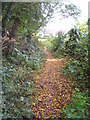

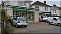
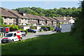
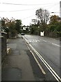
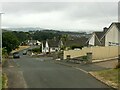
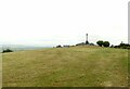

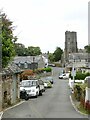
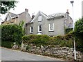
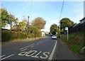
29 photos from this area
Area Information
Key information about the PL9 9JX including its size, population, and administrative classification.
- Area Type
- Postcode
- Area Size
- 1.1 hectares
- Population
- 1434
- Population Density
- 3422 people/km²
House Prices in PL9 9JX
20
Properties
£200,633
Average Sold Price
£50,000
Lowest Price
£345,000
Highest Price
Showing 20 properties
| Address | Type | Beds | Baths | Last Sale Price | Last Sale Date | |
|---|---|---|---|---|---|---|
| 38 Underlane, Plymstock, Plymouth, PL9 9JX | Semi-detached | 3 | 1 | £255,000 | Oct 2020 | |
| 30 Underlane, Plymstock, Plymouth, PL9 9JX | Semi-detached | 3 | 1 | £230,000 | Aug 2019 | |
| 34 Underlane, Plymstock, Plymouth, PL9 9JX | Semi-detached | 3 | 1 | £265,000 | Feb 2018 | |
| 32 Underlane, Plymstock, Plymouth, PL9 9JX | Semi-detached | 3 | 1 | £225,000 | May 2016 | |
| 36 Underlane, Plymstock, Plymouth, PL9 9JX | Semi-detached | 3 | 1 | £210,000 | Nov 2015 | |
| 2 Underlane, Plymstock, Plymouth, PL9 9JX | Bungalow | 2 | - | £185,000 | Dec 2014 | |
| 40 Underlane, Plymstock, Plymouth, PL9 9JX | house | 2 | - | £207,000 | Dec 2012 | |
| 18 Underlane, Plymstock, Plymouth, PL9 9JX | Bungalow | 4 | 2 | £345,000 | Jun 2011 | |
| 4 Underlane, Plymstock, Plymouth, PL9 9JX | Bungalow | 2 | - | £154,000 | Nov 2010 | |
| 16 Underlane, Plymstock, Plymouth, PL9 9JX | Bungalow | 2 | - | £250,000 | Nov 2010 |
Page 1 of 2
Energy Efficiency in PL9 9JX
Amenities
Schools
| Rank | School | Type | Entry gender | Ages |
|---|
Explore more schools in this area
Go to Schools tabDemographics
Household Size
Two person
most common
Accommodation Type
Houses
most common
Tenure
76
majority
Ethnic Group
White
most common
Religion
N/A
most common
Household Composition
N/A
most common
Age
47
median
Adults (30-64 years)
most common
Household Deprivation
N/A
with no deprivation
NS-SEC
37
in Lower managerial occupations
Explore more demographic insights in this area
Go to Demographics tabPlanning
Planning Constraints
- Flood RiskPremium
- Ramsar Wetland SitesPremium
- Area of Outstanding Natural BeautyPremium
- Protected Nature ReservePremium
- Protected WoodlandPremium