Area Overview for PL9 9GD
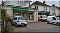
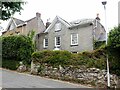
Photos of PL9 9GD


Area Information
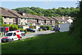
Living in PL9 9GD places you within a tightly defined residential cluster covering just 5399 square metres. This postcode represents a small, concentrated community in Plymouth, England, where the population reaches 1763 individuals. The area's limited physical size creates an immediate sense of locality, yet the population density is exceptionally high at 326548 people per square kilometre. Such density suggests a built-up environment where properties stand close together. Despite the small land area, this cluster functions as a distinct neighbourhood with access to wider Plymouth services. Prospective buyers looking for homes in PL9 9GD should expect a compact settlement rather than a sprawling suburb. The character here is defined by proximity to neighbours and established infrastructure. You will find yourself part of a community where daily interactions are facilitated by the close spacing of dwellings. The area serves as a specific residential zone within the broader city, offering a defined sense of place for those seeking a specific location within Plymouth's housing landscape.
- Area Type
- Postcode
- Area Size
- 5399 m²
- Population
- 1763
- Population Density
- 2609 people/km²
The property market in PL9 9GD is characterised by an overwhelming presence of owner-occupied homes. With 85% of households falling into the owner-occupier category, this is distinctly a buy-to-live area rather than a rental paradise. The accommodation type data confirms that houses dominate the housing stock, meaning you will find detached or semi-detached properties rather than flats or terraced blocks in this specific cluster. This predominance implies a traditional street scene where gardens and private space are common features. For buyers viewing homes in PL9 9GD, the high ownership rate suggests that the neighbourhood is built by people who intend to stay. There is very little transient renting activity, which can lead to lower noise levels and more stable management of shared spaces. The combination of houses and high ownership percentages creates an environment suited to families or empty-nesters who value security and consistency. You do not need to look for rental conversion potential here; the market caters to direct purchases for primary residence. This stability means that mortgage lenders view the area as low risk, potentially smoothing the path for finance approval.
House Prices in PL9 9GD
Showing 5 properties
| Address | Type | Beds | Baths | Last Sale Price | Last Sale Date | |
|---|---|---|---|---|---|---|
| 3 Badger View, Plymouth, PL9 9GD | Detached | 4 | 2 | £315,000 | Aug 2017 | |
| 4 Badger View, Plymouth, PL9 9GD | Detached | 5 | 3 | £370,000 | Feb 2017 | |
| 1 Badger View, Plymouth, PL9 9GD | Detached | 3 | 2 | £226,000 | Sep 2012 | |
| 2 Badger View, Plymouth, PL9 9GD | Detached | 5 | 3 | £350,000 | Mar 2006 | |
| 5 Badger View, Plymouth, PL9 9GD | Detached | 5 | 3 | £315,000 | Mar 2006 |
Energy Efficiency in PL9 9GD
Daily life in PL9 9GD benefits from a dense network of amenities located within practical reach. For your grocery shopping needs, you have three major supermarkets nearby: Iceland Plymstock, Lidl Elburton, and Asda Plymouth. These retailers cater to varied tastes and budgets, ensuring you can stock your home without travelling far. Transport options are equally comprehensive, with five ferry landing points including Plymouth Mount Batten Ferry Landing and Plymouth Ferry Terminal offering scenic sea journeys. Additionally, five rail stations serve the wider region, placing Plymouth Railway Station, Devonport Railway Station, and Dockyard Railway Station close to your door. Two airports, both identified as Plymouth City Airport, lie within the accessible network, facilitating domestic travel. This concentration of transport and retail hubs means you rarely need to venture outside your immediate parish for essential tasks. The area supports a balanced lifestyle where convenience and accessibility are constant features. You can manage your household budget, plan your commute, and enjoy leisure trips without significant travel time. The presence of these named venues like Asda Plymouth and Iceland Plymstock anchors the area within the broader Plymouth economy, providing security and familiarity for shoppers.
Amenities
Schools
| Rank | School | Type | Entry gender | Ages |
|---|
Explore more schools in this area
Go to Schools tabDemographics
The community in PL9 9GD is dominated by adults aged between 30 and 64 years. This age group represents the most common demographic, indicating that the area attracts families and those in their mid-life years. The median age stands at exactly 47, reflecting a mature population profile. Home ownership is extremely high, with 85% of households owning their property outright or with a mortgage. This figure significantly outpaces national averages and points to an established settlement where residents have settled for the long term. The predominant ethnic group is White, consistent with the broader demographic makeup of the region. Accommodation types in this cluster are primarily houses, suggesting family-oriented living arrangements rather than high-density apartments. The demographic data paints a picture of stability, where the majority of residents are long-term owner-occupiers. This stability often translates into a quiet, predictable neighbourhood atmosphere. You are likely to meet neighbours who have lived here for decades, creating a deep-rooted community feel. The absence of large student populations or renting pockets further reinforces the suitability of PL9 9GD for families seeking permanence.
Household Size
Accommodation Type
Tenure
Ethnic Group
Religion
Household Composition
Age
Household Deprivation
NS-SEC
Explore more demographic insights in this area
Go to Demographics tabPlanning
Planning Constraints
- Flood RiskPremium
- Ramsar Wetland SitesPremium
- Area of Outstanding Natural BeautyPremium
- Protected Nature ReservePremium
- Protected WoodlandPremium