Area Overview for PL9 9EZ
Photos of PL9 9EZ
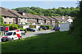
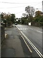
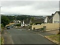
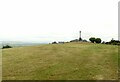
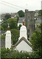
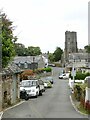
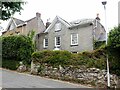
29 photos from this area
Area Information
Key information about the PL9 9EZ including its size, population, and administrative classification.
- Area Type
- Postcode
- Area Size
- 1.4 hectares
- Population
- 1553
- Population Density
- 2022 people/km²
House Prices in PL9 9EZ
41
Properties
£193,566
Average Sold Price
£44,500
Lowest Price
£300,000
Highest Price
Showing 41 properties
| Address | Type | Beds | Baths | Last Sale Price | Last Sale Date | |
|---|---|---|---|---|---|---|
| 111 Holmwood Avenue, Plymouth, PL9 9EZ | house | 3 | 1 | £235,000 | Jun 2025 | |
| 133 Holmwood Avenue, Plymouth, PL9 9EZ | Detached | 3 | 1 | £275,000 | May 2025 | |
| 91 Holmwood Avenue, Plymouth, PL9 9EZ | Semi-detached | 3 | 1 | £210,000 | Mar 2025 | |
| 95 Holmwood Avenue, Plymouth, PL9 9EZ | Semi-detached | 3 | 1 | £250,000 | Dec 2023 | |
| 116 Holmwood Avenue, Plymouth, PL9 9EZ | Semi-detached | 3 | 1 | £258,000 | Oct 2023 | |
| 143 Holmwood Avenue, Plymouth, PL9 9EZ | Semi-detached | 3 | 1 | £252,000 | Oct 2023 | |
| 105 Holmwood Avenue, Plymouth, PL9 9EZ | Semi-detached | 3 | 1 | £252,250 | May 2022 | |
| 106 Holmwood Avenue, Plymouth, PL9 9EZ | house | - | - | £220,000 | Jan 2022 | |
| 112 Holmwood Avenue, Plymouth, PL9 9EZ | house | - | - | £220,100 | Jul 2021 | |
| 109 Holmwood Avenue, Plymouth, PL9 9EZ | Detached | 3 | 1 | £209,000 | May 2021 |
Page 1 of 5
Energy Efficiency in PL9 9EZ
Amenities
Schools
| Rank | School | Type | Entry gender | Ages |
|---|
Explore more schools in this area
Go to Schools tabDemographics
Household Size
Family (3-5 people)
most common
Accommodation Type
Houses
most common
Tenure
76
majority
Ethnic Group
White
most common
Religion
N/A
most common
Household Composition
N/A
most common
Age
47
median
Adults (30-64 years)
most common
Household Deprivation
N/A
with no deprivation
NS-SEC
36
in Lower managerial occupations
Explore more demographic insights in this area
Go to Demographics tabPlanning
Planning Constraints
- Flood RiskPremium
- Ramsar Wetland SitesPremium
- Area of Outstanding Natural BeautyPremium
- Protected Nature ReservePremium
- Protected WoodlandPremium