Area Overview for PL9 8TT
Photos of PL9 8TT
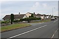
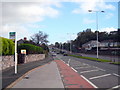
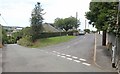
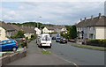
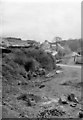
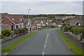
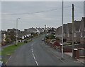
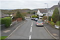
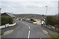
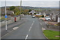
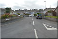
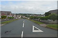
14 photos from this area
Area Information
Key information about the PL9 8TT including its size, population, and administrative classification.
- Area Type
- Postcode
- Area Size
- 8324 m²
- Population
- 1492
- Population Density
- 2301 people/km²
House Prices in PL9 8TT
16
Properties
£212,500
Average Sold Price
£54,500
Lowest Price
£390,000
Highest Price
Showing 16 properties
| Address | Type | Beds | Baths | Last Sale Price | Last Sale Date | |
|---|---|---|---|---|---|---|
| 20 Woodway, Plymouth, PL9 8TT | Bungalow | 2 | 1 | £345,000 | Aug 2022 | |
| 16 Woodway, Plymouth, PL9 8TT | Bungalow | 3 | 1 | £390,000 | Jul 2020 | |
| 12 Woodway, Plymouth, PL9 8TT | Semi-detached | 3 | 1 | £210,000 | Mar 2020 | |
| 14 Woodway, Plymouth, PL9 8TT | Detached | 3 | 2 | £282,000 | Jan 2017 | |
| 32 Woodway, Plymouth, PL9 8TT | Bungalow | 3 | 2 | £275,000 | Jan 2016 | |
| 4 Woodway, Plymouth, PL9 8TT | Semi-detached | 3 | 1 | £207,500 | Jan 2016 | |
| 30 Woodway, Plymouth, PL9 8TT | Bungalow | 3 | 1 | £245,500 | Feb 2015 | |
| 6 Woodway, Plymouth, PL9 8TT | Semi-detached | 3 | - | £219,000 | Jul 2014 | |
| 26 Woodway, Plymouth, PL9 8TT | Detached | 2 | - | £205,000 | Sep 2012 | |
| 8 Woodway, Plymouth, PL9 8TT | house | 3 | - | £182,000 | May 2012 |
Page 1 of 2
Energy Efficiency in PL9 8TT
Amenities
Schools
| Rank | School | Type | Entry gender | Ages |
|---|
Explore more schools in this area
Go to Schools tabDemographics
Household Size
Two person
most common
Accommodation Type
Houses
most common
Tenure
70
majority
Ethnic Group
White
most common
Religion
N/A
most common
Household Composition
N/A
most common
Age
47
median
Adults (30-64 years)
most common
Household Deprivation
N/A
with no deprivation
NS-SEC
31
in Lower managerial occupations
Explore more demographic insights in this area
Go to Demographics tabPlanning
Planning Constraints
- Flood RiskPremium
- Ramsar Wetland SitesPremium
- Area of Outstanding Natural BeautyPremium
- Protected Nature ReservePremium
- Protected WoodlandPremium