Area Overview for PL9 8HE
Photos of PL9 8HE
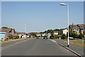
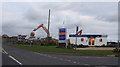
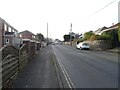
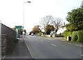
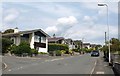
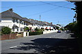
21 photos from this area
Area Information
Key information about the PL9 8HE including its size, population, and administrative classification.
- Area Type
- Postcode
- Area Size
- 1.7 hectares
- Population
- 1454
- Population Density
- 3882 people/km²
House Prices in PL9 8HE
27
Properties
£189,661
Average Sold Price
£56,000
Lowest Price
£467,000
Highest Price
Showing 27 properties
| Address | Type | Beds | Baths | Last Sale Price | Last Sale Date | |
|---|---|---|---|---|---|---|
| 53 Wembury Road, Plymouth, PL9 8HE | Detached | 3 | 3 | £467,000 | Apr 2024 | |
| 71 Wembury Road, Plymouth, PL9 8HE | Semi-detached | 3 | 1 | £190,000 | Jul 2020 | |
| 75 Wembury Road, Plymouth, PL9 8HE | Semi-detached | 2 | 1 | £146,000 | Nov 2016 | |
| 89 Wembury Road, Plymouth, PL9 8HE | Semi-detached | 3 | - | £153,000 | Dec 2014 | |
| 59 Wembury Road, Plymouth, PL9 8HE | Semi-detached | 3 | 1 | £184,000 | Feb 2013 | |
| 69 Wembury Road, Plymouth, PL9 8HE | house | 3 | - | £163,000 | Dec 2011 | |
| 105 Wembury Road, Plymouth, PL9 8HE | house | - | - | £173,000 | Nov 2009 | |
| 83 Wembury Road, Plymouth, PL9 8HE | Semi-detached | - | - | £174,950 | Jul 2007 | |
| 55 Wembury Road, Plymouth, PL9 8HE | Semi-detached | - | - | £56,000 | Nov 1996 | |
| 57 Wembury Road, Plymouth, PL9 8HE | Semi-detached | - | - | - | - |
Page 1 of 3
Energy Efficiency in PL9 8HE
Amenities
Schools
| Rank | School | Type | Entry gender | Ages |
|---|
Explore more schools in this area
Go to Schools tabDemographics
Household Size
Two person
most common
Accommodation Type
Houses
most common
Tenure
79
majority
Ethnic Group
White
most common
Religion
N/A
most common
Household Composition
N/A
most common
Age
47
median
Adults (30-64 years)
most common
Household Deprivation
N/A
with no deprivation
NS-SEC
31
in Lower managerial occupations
Explore more demographic insights in this area
Go to Demographics tabPlanning
Planning Constraints
- Flood RiskPremium
- Ramsar Wetland SitesPremium
- Area of Outstanding Natural BeautyPremium
- Protected Nature ReservePremium
- Protected WoodlandPremium