Area Overview for PL9 8FB
Photos of PL9 8FB
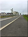
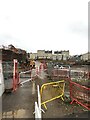
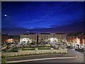
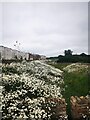
14 photos from this area
Area Information
Key information about the PL9 8FB including its size, population, and administrative classification.
- Area Type
- Postcode
- Area Size
- 2.6 hectares
- Population
- 2430
- Population Density
- 897 people/km²
House Prices in PL9 8FB
66
Properties
£255,320
Average Sold Price
£80,000
Lowest Price
£450,000
Highest Price
Showing 66 properties
| Address | Type | Beds | Baths | Last Sale Price | Last Sale Date | |
|---|---|---|---|---|---|---|
| 10 Pegasus Place, Sherford, PL9 8FB | Flat | 2 | 1 | £92,000 | Aug 2025 | |
| 11 Pegasus Place, Sherford, PL9 8FB | Terraced | 2 | 1 | £240,000 | Aug 2025 | |
| 17 Pegasus Place, Sherford, PL9 8FB | Semi-detached | 2 | 2 | £253,000 | Jul 2025 | |
| 82 Pegasus Place, Sherford, PL9 8FB | Terraced | 5 | 3 | £410,000 | Mar 2025 | |
| 4 Pegasus Place, Sherford, PL9 8FB | Retail | 2 | 1 | £220,000 | Mar 2025 | |
| 47 Pegasus Place, Sherford, PL9 8FB | Terraced | 2 | 1 | £238,500 | Feb 2025 | |
| 62 Pegasus Place, Sherford, PL9 8FB | Detached | 2 | 1 | £200,000 | Nov 2024 | |
| 3 Pegasus Place, Sherford, PL9 8FB | Detached | 2 | 1 | £207,000 | Sep 2024 | |
| 66 Pegasus Place, Sherford, PL9 8FB | Detached | 4 | 2 | £437,000 | Sep 2024 | |
| 8 Pegasus Place, Sherford, PL9 8FB | Maisonette | 2 | 1 | £210,000 | Aug 2024 |
Page 1 of 7
Energy Efficiency in PL9 8FB
Amenities
Schools
| Rank | School | Type | Entry gender | Ages |
|---|
Explore more schools in this area
Go to Schools tabDemographics
Household Size
Two person
most common
Accommodation Type
Houses
most common
Tenure
89
majority
Ethnic Group
White
most common
Religion
N/A
most common
Household Composition
N/A
most common
Age
47
median
Adults (30-64 years)
most common
Household Deprivation
N/A
with no deprivation
NS-SEC
42
in Lower managerial occupations
Explore more demographic insights in this area
Go to Demographics tabPlanning
Planning Constraints
- Flood RiskPremium
- Ramsar Wetland SitesPremium
- Area of Outstanding Natural BeautyPremium
- Protected Nature ReservePremium
- Protected WoodlandPremium