Area Overview for PL9 7LS
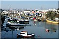
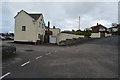
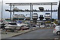
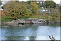
Photos of PL9 7LS


Area Information
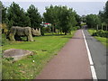
PL9 7LS is a compact residential cluster in Plymouth, covering an area of 2,213 square metres. This small postcode serves a population of 1,779 people, creating a focused community environment. The high population density suggests a built-up area where homes sit relatively close together, fostering an immediate neighbourhood feel. Living in PL9 7LS means you are situated in a well-established part of the city with defined boundaries. The location offers a mix of privacy through specific housing and proximity to wider Plymouth services. You will find yourself in a setting where daily life revolves around the immediate streets and accessible local transport links. The postcode itself acts as a marker for a specific cluster rather than a vast suburb, which can make local networks tighter and more personal. Residents enjoy a clear sense of place within the larger city structure. This area provides a solid foundation for those seeking a specific footprint within the urban fabric without the sprawl of outlying suburbs.
- Area Type
- Postcode
- Area Size
- 2213 m²
- Population
- 1779
- Population Density
- 3595 people/km²
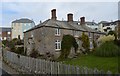
The property market in PL9 7LS is characterised by a strong preference for owner-occupied homes. With 79% of properties held by owners, this area functions primarily as a residential hub rather than a rental market. Houses constitute the main accommodation type, providing families with detached or semi-detached living spaces. This high ownership rate implies that the housing stock has been maintained by residents for extended periods. Buyers looking at this small postcode should expect to compete with other established owners rather than private landlords. The predominance of houses means you will find a scarcity of rental listings compared to flats or city-centre conversions. This market dynamic supports long-term value retention for sellers who wish to stay in the area. The housing marketplace here reflects a community where property is viewed as a permanent home base. Potential buyers should anticipate a selection of family-sized dwellings rather than starter properties intended for frequent turnover.
House Prices in PL9 7LS
Showing 19 properties
| Address | Type | Beds | Baths | Last Sale Price | Last Sale Date | |
|---|---|---|---|---|---|---|
| 11 Lapthorn Close, Plymouth, PL9 7LS | Flat | - | - | - | - | |
| 7 Lapthorn Close, Plymouth, PL9 7LS | Flat | - | - | - | - | |
| 14 Lapthorn Close, Plymouth, PL9 7LS | house | - | - | - | - | |
| 2 Lapthorn Close, Plymouth, PL9 7LS | house | - | - | - | - | |
| 5 Lapthorn Close, Plymouth, PL9 7LS | Flat | - | - | - | - | |
| 15 Lapthorn Close, Plymouth, PL9 7LS | Flat | - | - | - | - | |
| 10 Lapthorn Close, Plymouth, PL9 7LS | Terraced | - | - | - | - | |
| 6 Lapthorn Close, Plymouth, PL9 7LS | house | - | - | - | - | |
| 16 Lapthorn Close, Plymouth, PL9 7LS | house | - | - | - | - | |
| 20 Lapthorn Close, Plymouth, PL9 7LS | house | - | - | - | - |
Energy Efficiency in PL9 7LS
Living in PL9 7LS places you within practical reach of a wide variety of shops and transport hubs. Five retail outlets are located nearby, including Morrisons Elburton, Iceland Plymstock, and Co-op Embankment. These stores handle your weekly grocery needs and offer essential household items. Beyond food and retail, the area provides excellent transport links for leisure travel. Five ferry terminals, including Plymouth Mount Batten Ferry Landing and Plymouth Ferry Terminal, allow quick coastal excursions. Five railway stations such as Plymouth Railway Station and Dockyard Railway Station facilitate city travel. Two airport facilities, both named Plymouth City Airport, offer flight connections to holiday destinations. This density of amenities means you can shop locally or travel further afield without significant travel time. The convenience of having multiple Moses, retailers, and stations nearby defines the daily rhythm of life. You do not need to travel far for basic necessities or special occasion trips.
Amenities
Schools
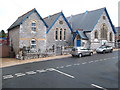
Families living in PL9 7LS benefit from direct access to formal education facilities nearby. Oreston Community Primary School serves the younger children in the catchment area. For secondary education, Oreston Community Academy is the designated option, holding a Good Ofsted rating. This specific rating confirms that the academy meets high standards for academic achievement and student behaviour. The presence of both a primary school and a good-rated academy reduces the need for commuting to distant institutions. You can rest assured that local schooling options are regulated and monitored by educational authorities. The proximity of these institutions means that most children in the postcode will attend local schools. This setup provides a clear educational pathway without the complexity of navigating different zones or applying for out-of-area placements. The school catchments are well defined for residents of this specific cluster.
| Rank | School | Type | Entry gender | Ages |
|---|
Explore more schools in this area
Go to Schools tabDemographics
The community in PL9 7LS is defined by a mature population profile. The median age stands at 47 years, reflecting a residents base where most residents fall into the 30 to 64 years category. This demographic skew indicates a stable population that is likely past the initial housing market entry phase. Home ownership is exceptionally high at 79%, suggesting a strong sense of established residency. The dominant accommodation type is houses, which aligns with the ownership figures and age profile. You will find that the local voting patterns and community engagement usually reflect the views of long-term residents. The predominant ethnic group is White, which contributes to a culturally familiar local environment. This demographic structure brings stability to the neighbourhood, with a population that has likely invested heavily in their local surroundings. The area does not have large pockets of transient population, allowing for long-standing community traditions to develop naturally over time.
Household Size
Accommodation Type
Tenure
Ethnic Group
Religion
Household Composition
Age
Household Deprivation
NS-SEC
Explore more demographic insights in this area
Go to Demographics tabPlanning
Planning Constraints
- Flood RiskPremium
- Ramsar Wetland SitesPremium
- Area of Outstanding Natural BeautyPremium
- Protected Nature ReservePremium
- Protected WoodlandPremium