Area Overview for PL7 5DU
Photos of PL7 5DU
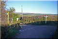

27 photos from this area
Area Information
Key information about the PL7 5DU including its size, population, and administrative classification.
- Area Type
- Postcode
- Area Size
- 78.1 hectares
- Population
- 1425
- Population Density
- 51 people/km²
House Prices in PL7 5DU
10
Properties
£297,500
Average Sold Price
£245,000
Lowest Price
£350,000
Highest Price
Showing 10 properties
| Address | Type | Beds | Baths | Last Sale Price | Last Sale Date | |
|---|---|---|---|---|---|---|
| Moorcot, Langage Cross To Moorcot, Venton, PL7 5DU | house | - | - | £350,000 | Jun 2018 | |
| Lyndhurst, Langage Cross To Moorcot, Venton, PL7 5DU | Detached | - | - | £245,000 | Apr 2001 | |
| 2, Stable Cottage, Mount Pleasant, Shipland To Challonsleigh, Venton, PL7 5DU | Cottage | 2 | - | - | - | |
| Shipland Cottage, Shipland To Challonsleigh, Venton, PL7 5DU | Bungalow | 4 | - | - | - | |
| Granny Annexe, Shipland Cottage, Shipland To Challonsleigh, Venton, PL7 5DU | Detached | - | - | - | - | |
| 4, Bryn Hyfryd, Mount Pleasant, Shipland To Challonsleigh, Venton, PL7 5DU | Terraced | - | - | - | - | |
| 1, Mount Pleasant, Shipland To Challonsleigh, Venton, PL7 5DU | Terraced | - | - | - | - | |
| 3, Mount Pleasant, Shipland To Challonsleigh, Venton, PL7 5DU | house | - | - | - | - | |
| Shipland Plantation, Sparkwell Cross To Shipland, Sparkwell, PL7 5DU | Detached | 4 | - | - | - | |
| Coombe Farm, Langage Cross To Moorcot, Venton, PL7 5DU | Farm | - | - | - | - |
Energy Efficiency in PL7 5DU
Amenities
Schools
| Rank | School | Type | Entry gender | Ages |
|---|
Explore more schools in this area
Go to Schools tabDemographics
Household Size
Two person
most common
Accommodation Type
Houses
most common
Tenure
65
majority
Ethnic Group
White
most common
Religion
N/A
most common
Household Composition
N/A
most common
Age
47
median
Adults (30-64 years)
most common
Household Deprivation
N/A
with no deprivation
NS-SEC
32
in Lower managerial occupations
Explore more demographic insights in this area
Go to Demographics tabPlanning
Planning Constraints
- Flood RiskPremium
- Ramsar Wetland SitesPremium
- Area of Outstanding Natural BeautyPremium
- Protected Nature ReservePremium
- Protected WoodlandPremium