Area Overview for PL7 4RQ
Photos of PL7 4RQ

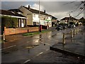
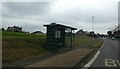
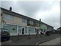
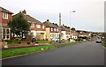
5 photos from this area
Area Information
Key information about the PL7 4RQ including its size, population, and administrative classification.
- Area Type
- Postcode
- Area Size
- 2.5 hectares
- Population
- 1601
- Population Density
- 5089 people/km²
House Prices in PL7 4RQ
73
Properties
£149,731
Average Sold Price
£51,000
Lowest Price
£298,000
Highest Price
Showing 73 properties
| Address | Type | Beds | Baths | Last Sale Price | Last Sale Date | |
|---|---|---|---|---|---|---|
| 2 Longacre, Plymouth, PL7 4RQ | Semi-detached | 3 | 1 | £298,000 | Apr 2023 | |
| 16 Longacre, Plymouth, PL7 4RQ | Detached | 3 | 1 | £220,000 | Jan 2022 | |
| 18 Longacre, Plymouth, PL7 4RQ | house | - | - | £135,000 | May 2021 | |
| 53 Longacre, Plymouth, PL7 4RQ | Bungalow | - | - | £190,000 | Feb 2021 | |
| 26 Longacre, Plymouth, PL7 4RQ | house | - | - | £230,000 | Feb 2021 | |
| 45 Longacre, Plymouth, PL7 4RQ | Semi-detached | 2 | 1 | £195,000 | Jul 2019 | |
| 12 Longacre, Plymouth, PL7 4RQ | Semi-detached | 3 | - | £210,000 | Apr 2019 | |
| 51 Longacre, Plymouth, PL7 4RQ | Semi-detached | 2 | - | £186,000 | Feb 2019 | |
| 56 Longacre, Plymouth, PL7 4RQ | Semi-detached | 3 | 1 | £265,000 | Jan 2019 | |
| 40 Longacre, Plymouth, PL7 4RQ | Semi-detached | 3 | 1 | £197,500 | Sep 2016 |
Page 1 of 8
Energy Efficiency in PL7 4RQ
Amenities
Schools
| Rank | School | Type | Entry gender | Ages |
|---|
Explore more schools in this area
Go to Schools tabDemographics
Household Size
Family (3-5 people)
most common
Accommodation Type
Houses
most common
Tenure
87
majority
Ethnic Group
White
most common
Religion
N/A
most common
Household Composition
N/A
most common
Age
47
median
Adults (30-64 years)
most common
Household Deprivation
N/A
with no deprivation
NS-SEC
34
in Lower managerial occupations
Explore more demographic insights in this area
Go to Demographics tabPlanning
Planning Constraints
- Flood RiskPremium
- Ramsar Wetland SitesPremium
- Area of Outstanding Natural BeautyPremium
- Protected Nature ReservePremium
- Protected WoodlandPremium