Area Overview for PL7 4NU
Photos of PL7 4NU

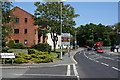

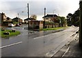
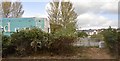
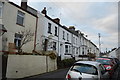
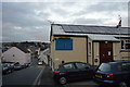

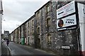
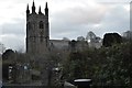

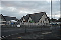
54 photos from this area
Area Information
Key information about the PL7 4NU including its size, population, and administrative classification.
- Area Type
- Postcode
- Area Size
- 1.6 hectares
- Population
- 1601
- Population Density
- 5089 people/km²
House Prices in PL7 4NU
42
Properties
£185,658
Average Sold Price
£42,500
Lowest Price
£325,000
Highest Price
Showing 42 properties
| Address | Type | Beds | Baths | Last Sale Price | Last Sale Date | |
|---|---|---|---|---|---|---|
| 64 Molesworth Road, Plympton, Plymouth, PL7 4NU | Semi-detached | 3 | 1 | £312,000 | Aug 2024 | |
| 57 Molesworth Road, Plympton, Plymouth, PL7 4NU | Semi-detached | 3 | 2 | £275,000 | May 2024 | |
| 80 Molesworth Road, Plympton, Plymouth, PL7 4NU | Retail | 3 | 1 | £210,000 | Aug 2023 | |
| 72 Molesworth Road, Plympton, Plymouth, PL7 4NU | Semi-detached | 3 | 1 | £320,000 | Jun 2023 | |
| 62 Molesworth Road, Plympton, Plymouth, PL7 4NU | house | - | - | £325,000 | Aug 2022 | |
| 50 Molesworth Road, Plympton, Plymouth, PL7 4NU | house | - | - | £270,000 | Mar 2022 | |
| 49 Molesworth Road, Plympton, Plymouth, PL7 4NU | Semi-detached | 2 | 1 | £220,000 | Sep 2020 | |
| 77 Molesworth Road, Plympton, Plymouth, PL7 4NU | Semi-detached | 3 | 1 | £210,000 | Dec 2018 | |
| 76 Molesworth Road, Plympton, Plymouth, PL7 4NU | Semi-detached | 3 | 1 | £220,000 | Aug 2018 | |
| 79 Molesworth Road, Plympton, Plymouth, PL7 4NU | Semi-detached | 3 | 1 | £208,000 | Dec 2017 |
Page 1 of 5
Energy Efficiency in PL7 4NU
Amenities
Schools
| Rank | School | Type | Entry gender | Ages |
|---|
Explore more schools in this area
Go to Schools tabDemographics
Household Size
Family (3-5 people)
most common
Accommodation Type
Houses
most common
Tenure
87
majority
Ethnic Group
White
most common
Religion
N/A
most common
Household Composition
N/A
most common
Age
47
median
Adults (30-64 years)
most common
Household Deprivation
N/A
with no deprivation
NS-SEC
34
in Lower managerial occupations
Explore more demographic insights in this area
Go to Demographics tabPlanning
Planning Constraints
- Flood RiskPremium
- Ramsar Wetland SitesPremium
- Area of Outstanding Natural BeautyPremium
- Protected Nature ReservePremium
- Protected WoodlandPremium