Area Overview for PL7 4HZ
Photos of PL7 4HZ

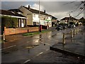
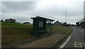
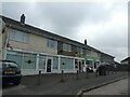
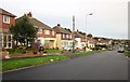
5 photos from this area
Area Information
Key information about the PL7 4HZ including its size, population, and administrative classification.
- Area Type
- Postcode
- Area Size
- 8959 m²
- Population
- 1476
- Population Density
- 2107 people/km²
House Prices in PL7 4HZ
27
Properties
£163,445
Average Sold Price
£51,000
Lowest Price
£280,000
Highest Price
Showing 27 properties
| Address | Type | Beds | Baths | Last Sale Price | Last Sale Date | |
|---|---|---|---|---|---|---|
| 121 Crossway, Plymouth, PL7 4HZ | Semi-detached | 3 | 1 | £280,000 | Mar 2025 | |
| 119 Crossway, Plymouth, PL7 4HZ | Semi-detached | 3 | 1 | £263,000 | Oct 2024 | |
| 103 Crossway, Plymouth, PL7 4HZ | Semi-detached | 3 | 1 | £265,950 | Aug 2022 | |
| 97 Crossway, Plymouth, PL7 4HZ | Semi-detached | 3 | 1 | £238,000 | Jun 2020 | |
| 120 Crossway, Plymouth, PL7 4HZ | Semi-detached | 3 | 1 | £175,000 | Nov 2014 | |
| 118 Crossway, Plymouth, PL7 4HZ | house | 3 | - | £174,000 | Oct 2012 | |
| 112 Crossway, Plymouth, PL7 4HZ | house | - | - | £148,000 | Jun 2009 | |
| 113 Crossway, Plymouth, PL7 4HZ | house | - | - | £70,000 | Jun 2000 | |
| 110 Crossway, Plymouth, PL7 4HZ | Semi-detached | - | - | £78,950 | Dec 1999 | |
| 111 Crossway, Plymouth, PL7 4HZ | Semi-detached | - | - | £54,000 | Dec 1996 |
Page 1 of 3
Energy Efficiency in PL7 4HZ
Amenities
Schools
| Rank | School | Type | Entry gender | Ages |
|---|
Explore more schools in this area
Go to Schools tabDemographics
Household Size
Two person
most common
Accommodation Type
Houses
most common
Tenure
84
majority
Ethnic Group
White
most common
Religion
N/A
most common
Household Composition
N/A
most common
Age
47
median
Adults (30-64 years)
most common
Household Deprivation
N/A
with no deprivation
NS-SEC
31
in Lower managerial occupations
Explore more demographic insights in this area
Go to Demographics tabPlanning
Planning Constraints
- Flood RiskPremium
- Ramsar Wetland SitesPremium
- Area of Outstanding Natural BeautyPremium
- Protected Nature ReservePremium
- Protected WoodlandPremium