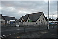
Area Overview for PL7 3QR
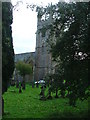
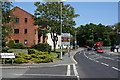
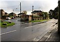
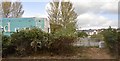
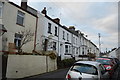
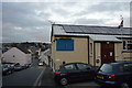
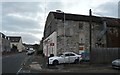
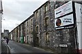
Photos of PL7 3QR


Area Information
Living in PL7 3QR means residing within a small, tightly defined residential cluster in Plympton, England. This specific postcode area forms a quiet pocket of the broader community, currently home to 1,652 residents. The population density stands at 1,422 people per square kilometre, creating an environment that feels settled and established rather than chaotic or sprawling. You are in a region defined by its residential focus, where the immediate landscape is dominated by domestic life rather than heavy industry or commercial hubs. Daily life here involves navigating a neighbourhood where families and long-term residents share the streets. The area is located in Devon, close to the larger town of Plympton, which provides a buffer of anonymity while keeping you connected to wider services. This small cluster offers a sense of closeness without the noise and congestion often associated with larger urban centres. It is a place where you know your neighbours, and the streets are designed for people walking through them rather than just vehicles passing by. The distinct character of PL7 3QR comes from its compact nature and high level of occupancy. With almost two-thirds of a thousand souls living in a relatively small footprint, the community has a defined identity. You can expect a pace of life that allows for substantial use of outdoor spaces and local facilities without the pressure of a major city commute. It is a straightforward, functional area where the house, the garden, and the local street form the core of your everyday experience.
- Area Type
- Postcode
- Area Size
- Not available
- Population
- 1652
- Population Density
- 1422 people/km²
The property market in PL7 3QR is characterised by a near-total lack of rental properties. With 82% of homes owned outright, this area represents a solid, owner-occupied market rather than a landlord-dominated zone. This high ownership percentage means you are joining a community where most residents have lived there for years, often passing through the estate agent with the intention of staying indefinitely. When selling a home in this postcode, you benefit from the stability of an area where people value long-term tenure. All accommodation in PL7 3QR comprises houses, which sets a clear standard for the housing stock. You will find no purpose-built flats or apartments listed within this specific cluster. The prevalence of houses indicates that everyone who resides here has access to private grounds and the architectural form typically associated with family life. This uniformity in property type simplifies the visual character of the neighbourhood and supports a consistent local amenity infrastructure. For buyers looking at this small area and its immediate surroundings, the market reflects a mature preference for traditional ownership. The high level of home ownership suggests that the area has been attractive to families looking to buy rather than rent. This dynamic creates a competitive but stable environment where property prices are likely to be supported by the demographic need for permanent housing. You are entering a market where the focus is on acquisition and residency rather than speculation. The presence of so many homeowners ensures that local services are tailored to a settled population. When you look for homes in PL7 3QR, you are searching for properties that serve as a permanent base for life, making the area a practical choice for those seeking to establish a long-term home in Devon.
House Prices in PL7 3QR
No properties found in this postcode.
Energy Efficiency in PL7 3QR
Daily life in PL7 3QR is supported by a network of amenities located within practical reach. You have access to five retail outlets, specifically including Tesco Plympton, Co-op Ridgeway, and Iceland Plympton. These named stores mean you can purchase groceries, fresh produce, and everyday necessities without extensive driving. The presence of a supermarket and convenience store ensures that your shopping lists can be met locally, saving time on long journeys to larger commercial districts. Transport infrastructure further enhances your lifestyle with five airports and five ferry terminals nearby. Plymouth City Airport stands out as a key facility, offering flights for business or leisure travel. The five ferry facilities, such as Plymouth Mount Batten Ferry Landing and Plymouth Landing Stage, provide regular crossings to Saltash and Cornwall. For residents who enjoy weekend trips or regular travel, this density of transport nodes is a significant lifestyle plus. Rail connectivity adds another layer of convenience with five stations to choose from. Plymouth Railway Station and Devonport Railway Station are major hubs that handle intercity and commuter services. Dockyard Railway Station serves the historic visitor route to the Royal Citadel. Having this many stations implies that the area is well-integrated into the wider transport grid, making it easy to explore further afield. Lounge at your ease knowing that these amenities are never far away. The combination of local shops and regional transport hubs means you can manage errands on foot or by car and then head out for a longer journey in the same day. This blend of local and regional access defines the convenience of living in this postcode.
Amenities
Schools
Families considering PL7 3QR will find a clear educational option nearby for younger children. The nearest institution is Plympton St Mary's CofE Infant School, which appears in the data with two distinct classifications. One entry lists it as a primary school, while the other identifies it as an academy with a 'good' Ofsted rating. This specific rating indicates that the school performs well against national standards and meets the requirements for quality education. The mix of school types shown here is limited to primary and academy sectors, suggesting that meeting the needs of infants and primary-aged children is the immediate focus for residents. You do not see comprehensive or secondary schools listed in the immediate data for this specific postcode, which implies that older children may need to travel further for their secondary education. For parents with toddlers or young children, however, the presence of Plympton St Mary's CofE Infant School provides a direct, high-rated option. The school being an academy means it operates with significant autonomy from the local authority, often allowing for innovative teaching methods and targeted support. The 'good' rating is a concrete fact that can provide reassurance when assessing the educational environment. If you are living in PL7 3QR, you ensure your younger children have access to a facility that is already rated highly by inspectors before considering further education options. This proximity means you can drop children at school with minimal travel time. The specific naming of Plympton St Mary's ties the school directly to the local parish and community history. While data on specific catchment zones is not provided, the physical closeness of the school to the residential cluster is evident. For those prioritising education, this area offers a verified starting point for primary schooling within a safe, local context.
| Rank | School | Type | Entry gender | Ages |
|---|
Explore more schools in this area
Go to Schools tabDemographics
The community in PL7 3QR is largely defined by stability and maturity. The median age of residents is 47 years, which indicates a population skewed towards middle-aged adults and families. Most households consist of adults aged between 30 and 64 years, meaning you are surrounded by people in their prime earning and parenting decades. This demographic profile suggests a neighbourhood where children are common, but the residents have passed the early stages of career building. Home ownership is the overwhelming norm in this postcode. An 82% ownership rate reveals a community where families have put down roots rather than viewing homes as short-term investments. Only a small minority of residents rent their properties, creating a stable environment where neighbours tend to stay for generations. This long-term residency builds strong social bonds and ensures that local decisions stay consistent over time. The housing stock consists entirely of houses, with no apartments or flats recorded for this specific cluster. This detail confirms that every parcel of land in PL7 3QR is zoned for detached or semi-detached living, offering privacy and space. The predominant ethnic group is White, which aligns with the wider historical settlement patterns of the area. There is no data suggesting significant ethnic diversity at this specific micro-level, reinforcing the feeling of a traditional, established English suburb. For buyers assessing the area, these figures signal a quiet, secure environment. You will not encounter the churn of a student village or the transient nature of a tourist hub. Instead, you join a group of homeowners who value permanence and local continuity. The age profile ensures that local schools and community groups have a substantial adult base to support them.
Household Size
Accommodation Type
Tenure
Ethnic Group
Religion
Household Composition
Age
Household Deprivation
NS-SEC
Explore more demographic insights in this area
Go to Demographics tabPlanning
Planning Constraints
- Flood RiskPremium
- Ramsar Wetland SitesPremium
- Area of Outstanding Natural BeautyPremium
- Protected Nature ReservePremium
- Protected WoodlandPremium