Area Overview for PL7 2XJ
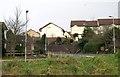
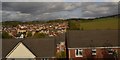
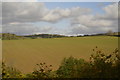
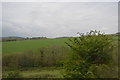
Photos of PL7 2XJ


Area Information
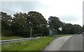
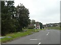
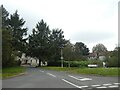
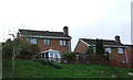
Living in PL7 2XJ offers a distinct experience defined by its compact residential cluster nature. This specific postcode covers a small population of 1,496 people, creating a close-knit environment rather than the sprawling anonymity of larger urban zones. The area sits firmly in England, away from the city centre yet close enough to major transport hubs to remain connected to wider networks. Daily life here revolves around stability and established communities, supported by high rates of home ownership and a predominantly English population. The housing stock consists almost entirely of houses, suggesting a family-oriented layout with gardens and private outdoor space. Residents enjoy a quiet existence free from major planning constraints. There are no areas of outstanding natural beauty, protected woodlands, or Ramsar wetland sites impacting development or views. The local environment presents low flood risk, which provides peace of mind regarding climate-related safety concerns. For those seeking homes in PL7 2XJ, the setting is practical and secure. The small population numbers mean you will likely know your neighbours quickly, fostering a sense of shared responsibility for the local streets. This is not a tourist destination or a commercial hub; it is a residential pocket designed for people who value stability and a slower pace of life while maintaining access to essential services like shopping and transport links in nearby Plympton and beyond.
- Area Type
- Postcode
- Area Size
- Not available
- Population
- 1496
- Population Density
- 5109 people/km²
The property market in PL7 2XJ is characterised by strong establishment rather than rapid turnover. With 87% of residents owning their homes, the area skews heavily towards owner-occupation. This statistic means that around one in seven homes might be rented, while the vast majority reflect families or individuals who have purchased properties to live in long term. The accommodation type is exclusively houses, so you will not find flats or purpose-built apartments listed for sale within this specific postcode boundary. For buyers looking at homes in PL7 2XJ, this implies a focus on detached or semi-detached properties, likely with gardens and private street frontages. The small population of 1,496 supports a stable market without the frenetic activity found in major cities. Inventory listings may be limited at any given time, meaning competition often centres on private sales rather than public estate auctions or chain reactions involving multiple buyers. The area lacks significant planning constraints such as protected woodlands or nature reserves, which removes common hurdles faced by developers or buyers looking to extend. This absence of restrictions can make the area attractive for those wishing to undertake approved home improvements. While prices are not explicitly detailed in the current dataset, the high home ownership rate and lack of rental units suggest a market driven by affordability for first-time buyers moving up or for empty-nesters selling their original family homes. The concentration of houses supports a local economy based on maintenance, gardening, and local services rather than high-density urban living costs.
House Prices in PL7 2XJ
No properties found in this postcode.
Energy Efficiency in PL7 2XJ
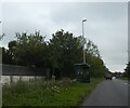
Life in PL7 2XJ balances rural tranquility with accessible retail and transport facilities. Five major retail venues sit within practical reach, ensuring you never need to drive far for groceries or essentials. These include Tesco Plympton, Co-op Chaddlewood, and Aldi Galileo, providing a solid choice for budget-conscious shoppers and those seeking larger-format supermarkets. For families, the local shopping offers a mix of fresh produce, household goods, and everyday items without the need to travel to Plymouth city centre. Leisure and transport amenities further enhance daily life in this residential cluster. Residents have five ferry landing options nearby, including Plymouth Mount Batten Ferry Landing, which connects to popular coastal destinations. Air travel is supported by two nearby airports, providing quick connections to major UK cities. Four railway stations, including Ivybridge Railway Station and Plymouth Railway Station, offer frequent departures to the south-west and beyond. There are no area descriptions indicating protected woodlands or nature reserves within the immediate vicinity, which allows for open views and straightforward property development potential. The area's character is defined by this proximity to good transport and shopping without the noise and congestion of urban centres. You can enjoy the quiet of a house in a small cluster while still accessing a supermarket, a train station, and a ferry terminal within a reasonable drive or cycle time. This layout supports a lifestyle where convenience comes standard, yet the home environment remains predominantly suburban or semi-rural.
Amenities
Schools
Families moving to PL7 2XJ have several primary education options immediately available within the local cluster. Chaddlewood Infants' School serves the younger children, providing foundational education for the earliest years. Just across the street or nearby, Chaddlewood Junior School takes over once children reach the appropriate age for middle school years. Additionally, Chaddlewood Primary School operates in the area, offering another legitimate choice for primary education depending on specific catchment boundaries and open places. One of these primary institutions, Chaddlewood Primary School, holds a Ofsted rating of 'good'. This rating confirms that the school meets high standards of education and leadership, lending confidence to parents choosing this area for their children's futures. The concentration of schools named Chaddlewood indicates a well-resourced local educational hub rather than a scattered network. Because PL7 2XJ is a small residential cluster, these schools serve as community anchors where many local children attend. The mix of infant and junior provision within a few hundred metres of the postcode suggests convenience for parents managing school run logistics. There are no secondary schools or high schools listed in the immediate data for this specific cluster, meaning older children may need to travel further for secondary education, though the primary provision is robust and consistent. The presence of three primary schools offers some flexibility in school selection for families considering homes in this postcode.
| Rank | School | Type | Entry gender | Ages |
|---|
Explore more schools in this area
Go to Schools tabDemographics
The community within PL7 2XJ is mature and settled, reflecting a demographic profile dominated by adults aged between 30 and 64 years. The median age for residents is 47, indicating that families with grown children or retirees form the core of the local population. With an 87% home ownership rate, the area functions primarily as a residential estate where people live rather than rent. This high level of tenure suggests residents are likely to stay in one home for many years, contributing to social continuity and reduced turnover compared to rental-heavy districts. Houses constitute the standard accommodation type, reinforcing the character of the neighbourhood as a place for larger living spaces rather than apartments. The predominant ethnic group is White, which aligns with the broader demographic trends of much of rural and semi-rural England. You will find a mix of household types, but the overwhelming majority of dwellings reflect long-term ownership. The population of 1,496 individuals creates a manageable community size where local events and school productions can genuinely impact the entire demographic. Safety data further reflects this stable character, with a crime risk score of 77 out of 100, placing the area in a lower-risk bracket. This statistical measure indicates crime rates below the national average, allowing residents to move about with confidence. The demographic mix supports traditional family life, with few transient populations disrupting the established fabric of the neighbourhood.
Household Size
Accommodation Type
Tenure
Ethnic Group
Religion
Household Composition
Age
Household Deprivation
NS-SEC
Explore more demographic insights in this area
Go to Demographics tabPlanning
Planning Constraints
- Flood RiskPremium
- Ramsar Wetland SitesPremium
- Area of Outstanding Natural BeautyPremium
- Protected Nature ReservePremium
- Protected WoodlandPremium