Area Overview for PL7 2LF
Photos of PL7 2LF


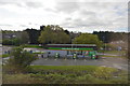
64 photos from this area
Area Information
Key information about the PL7 2LF including its size, population, and administrative classification.
- Area Type
- Postcode
- Area Size
- 1.4 hectares
- Population
- 1532
- Population Density
- 2172 people/km²
House Prices in PL7 2LF
18
Properties
£151,396
Average Sold Price
£54,000
Lowest Price
£282,500
Highest Price
Showing 18 properties
| Address | Type | Beds | Baths | Last Sale Price | Last Sale Date | |
|---|---|---|---|---|---|---|
| 5 Mallard Close, Plymouth, PL7 2LF | Semi-detached | 3 | 1 | £282,500 | Oct 2024 | |
| 10 Mallard Close, Plymouth, PL7 2LF | Semi-detached | 3 | 1 | £240,000 | Jan 2023 | |
| 11 Mallard Close, Plymouth, PL7 2LF | Semi-detached | 3 | 1 | £200,000 | Jul 2019 | |
| 2 Mallard Close, Plymouth, PL7 2LF | Detached | 4 | 1 | £230,000 | Jun 2017 | |
| 1 Mallard Close, Plymouth, PL7 2LF | house | - | - | £239,000 | Jul 2011 | |
| 3 Mallard Close, Plymouth, PL7 2LF | house | - | - | £160,000 | Aug 2009 | |
| 17 Mallard Close, Plymouth, PL7 2LF | Semi-detached | - | - | £135,000 | Jan 2004 | |
| 19 Mallard Close, Plymouth, PL7 2LF | Semi-detached | - | - | £90,000 | Jun 2001 | |
| 6 Mallard Close, Plymouth, PL7 2LF | Semi-detached | - | - | £62,000 | Jan 2000 | |
| 15 Mallard Close, Plymouth, PL7 2LF | Semi-detached | 3 | 1 | £59,750 | Oct 1998 |
Page 1 of 2
Energy Efficiency in PL7 2LF
Amenities
Schools
| Rank | School | Type | Entry gender | Ages |
|---|
Explore more schools in this area
Go to Schools tabDemographics
Household Size
Two person
most common
Accommodation Type
Houses
most common
Tenure
86
majority
Ethnic Group
White
most common
Religion
N/A
most common
Household Composition
N/A
most common
Age
47
median
Adults (30-64 years)
most common
Household Deprivation
N/A
with no deprivation
NS-SEC
33
in Lower managerial occupations
Explore more demographic insights in this area
Go to Demographics tabPlanning
Planning Constraints
- Flood RiskPremium
- Ramsar Wetland SitesPremium
- Area of Outstanding Natural BeautyPremium
- Protected Nature ReservePremium
- Protected WoodlandPremium