Area Overview for PL7 2HS
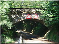
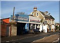
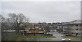
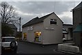
Photos of PL7 2HS


Area Information
PL7 2HS is a specific postcode area covering a small residential cluster in Plimpton. It sits within a very tight 9,720 square metre footprint, creating a dense environment for its 1,370 residents. The location's compact size results in an extremely high population density of 140,952 people per square kilometre, indicating a neighbourhood where space is at a premium. Living in this postcode means you are part of an urban residential pocket that is close to Plymouth. The area functions as a focused living zone rather than a sprawling suburb, concentrating homes and amenities into a manageable radius. You will find that daily life here revolves around immediate proximity, with no need for long commutes to reach basic necessities. The sheer density suggests a community where neighbours are likely within shouting distance, fostering a close-knit environment characteristic of small residentialpockets. This urban clustering offers convenience but also means privacy is a consideration compared to vast single-family estates. PL7 2HS delivers a lived-in feel defined by its concentrated nature and efficient use of available land. The community in PL7 2HS is defined by its age profile and household composition. The median age here is 47 years, with the most common age range comprising adults between 30 and 64 years. This demographic skew indicates a neighbourhood dominated by middle-aged families and established professionals rather than young students or retirees. You will find that 49% of households own their homes, meaning just under half of the residents hold a mortgage or own outright while the other half likely rent. The accommodation type consists primarily of houses, suggesting a preference for full homes over flats or terraced properties in this specific cluster. Predominantly, the population identifies as White, reflecting the broader national profile common in this region. There is no data provided on deprivation levels, so specific statistics regarding income disparity or council tax benefit reliance cannot be stated. However, the high density and age profile suggest a stable community where residents likely have significant ties to the local area. The population mix points to a mature settlement where established families reside alongside those approaching retirement. The property market in PL7 2HS is characterised by a distinct lack of large-scale rental properties compared to university hubs. With 49% home ownership, nearly half of the residents possess equity and stability within their dwellings. This figure indicates a balanced mix of owner-occupiers and tenants, but the limited area size restricts the volume of housing stock available for trade. The accommodation type is listed as houses, meaning you will primarily find detached, semi-detached, or terraced family homes rather than blocks of flats. Buying homes in PL7 2HS offers a chance to enter a market with significant owner-occupation rates, which can influence local amenity investment and community investment. The small footprint of 9,720 square metres limits the number of active sales, creating a competitive environment where few listings turn over at any one time. You must act quickly if you spot a suitable house in this postcode, as inventory turnover is naturally low in such a compact residential cluster. The market here is not about luxury or prestige but about securing a house within a highly sought-after, densely populated location near Plymouth. Families living in PL7 2HS have access to specific educational institutions nearby. Plympton St Maurice Primary School serves the local community as a primary education provider. It is listed twice in the available records, indicating it is a key facility for young children in the area. Longcause Community Special School also operates close by, offering specialised education for students with specific needs. This mix of a standard primary school and a special school suggests the local infrastructure supports a range of educational requirements for children residing in the postcode. There are no secondary schools listed immediately adjacent to PL7 2HS, so older pupils would likely commute further for comprehensive or technical education. The presence of these two institutions means you do not need to look far for educational options if you have young children. Living in PL7 2HS places daily school runs within a short, practical distance of your home. The school proximity is a tangible benefit for parents evaluating this dense residential postcode. Connectivity for residents of PL7 2HS is supported by robust digital infrastructure and extensive transport links nearby. The fixed broadband quality score reaches 93 out of 100, which classifies the internet connection as excellent for working from home or streaming high-quality content. Mobile coverage scores 84 out of 100, providing good signal strength for communication and navigation throughout the postcode. You can rely on high-speed internet for professional tasks without frequent interruptions, a crucial factor for modern households. Around the area, you can access Plymouth City Airport for domestic travel, benefiting from a score of 2 notable locations indicating strong local representation. Rail connections include Plymouth Railway Station, Devonport Railway Station, and Dockyard Railway Station, all situated within practical reach for commuters. Additionally, there are five ferry landing points available, including Plymouth Mount Batten Ferry Landing and Newton Ferrers Ferry Landing. These options provide diverse travel methods, allowing you to choose between rail, ferry, or air to suit your destination. Living in PL7 2HS ensures you are well-connected to wider Cornwall and Devon through these varied transport modes. Your lifestyle in PL7 2HS benefits from a cluster of amenities within practical reach. For shopping, five retail outlets are available, including Tesco Plympton, Iceland Plympton, and the Co-op on Ridgeway. These stores provide daily essentials without requiring a long drive into Plymouth city centre. Transport options are abundant with two airports, five railway stations, and five ferry landing stages nearby. These facilities include Plymouth City Airport, Plymouth Railway Station, and Newton Ferrers Ferry Landing. Such density of transport hubs means you have multiple ways to travel for leisure or business, reducing reliance on cars for long-distance trips. While the data does not specify parks or leisure centres, the proximity of ferry landings often implies access to coastal paths and waterfront activities typical of Plymouth's coastline. The area feels convenient yet functional, catering to daily needs through the availability of major supermarkets and rail links. Living in PL7 2HS organises your day around engaging with these specific, named services whenever you need to step outside your front door. Safety in PL7 2HS presents a mixed picture that requires resident vigilance. The crime risk assessment carries a warning level with a score of 50 out of 100, indicating a medium crime risk where rates are around average. You should apply standard security precautions such as locking doors and being aware of your surroundings, as the area is not crime-free. Despite this, the area passes safety assessments for flood risk, Ramsar wetland sites, and Areas of Outstanding Natural Beauty, all scoring 0 or low risk. This means flooding is not a significant threat to your property values or daily routine. The absence of Ramsar wetlands means no strict UK wilderness site protections apply, potentially simplifying garden renovations. Furthermore, there is no protected nature reserve or protected woodland within the postcode boundary, so you are free from the planning restrictions associated with such designations. While the medium crime score warrants caution, the environmental safety scores confirm that the physical land is stable and free from major natural hazards. Living here requires a balance of standard urban caution and confidence in the environmental stability of the land. Who typically lives in PL7 2HS?The residents are predominantly adults aged between 30 and 64 years, with a median age of 47. A specific postcode area covering a small residential cluster, PL7 2HS, has a population of 1370 people. Just under half of the households, specifically 49%, own their homes while the accommodation type consists mainly of houses. What schools are near PL7 2HS?Residents have two main educational options listed nearby. Plympton St Maurice Primary School serves as a primary school for younger children. Longcause Community Special School provides special education services. These institutions are the only schools listed in the available data for the area. How safe is living in PL7 2HS?The area carries a warning level for crime risk with a score of 50 out of 100, indicating medium crime rates that are around average. However, the area passes safety assessments for flood risk and environmental planning constraints. There is no mention of flooding, Ramsar wetlands, or protected nature reserves affecting the postcode. What amenities are close to PL7 2HS?You have access to five retail outlets including Tesco Plympton, Iceland Plympton, and Co-op Ridgeway. Transport connections include Plymouth City Airport, five railway stations, and five ferry landings such as Plymouth Mount Batten Ferry Landing. These facilities are within practical reach of the 9,720 square metre residential cluster.
- Area Type
- Postcode
- Area Size
- 9720 m²
- Population
- 1370
- Population Density
- 2735 people/km²
The property market in PL7 2HS is characterised by a distinct lack of large-scale rental properties compared to university hubs. With 49% home ownership, nearly half of the residents possess equity and stability within their dwellings. This figure indicates a balanced mix of owner-occupiers and tenants, but the limited area size restricts the volume of housing stock available for trade. The accommodation type is listed as houses, meaning you will primarily find detached, semi-detached, or terraced family homes rather than blocks of flats. Buying homes in PL7 2HS offers a chance to enter a market with significant owner-occupation rates, which can influence local amenity investment and community investment. The small footprint of 9,720 square metres limits the number of active sales, creating a competitive environment where few listings turn over at any one time. You must act quickly if you spot a suitable house in this postcode, as inventory turnover is naturally low in such a compact residential cluster. The market here is not about luxury or prestige but about securing a house within a highly sought-after, densely populated location near Plymouth. Families living in PL7 2HS have access to specific educational institutions nearby. Plympton St Maurice Primary School serves the local community as a primary education provider. It is listed twice in the available records, indicating it is a key facility for young children in the area. Longcause Community Special School also operates close by, offering specialised education for students with specific needs. This mix of a standard primary school and a special school suggests the local infrastructure supports a range of educational requirements for children residing in the postcode. There are no secondary schools listed immediately adjacent to PL7 2HS, so older pupils would likely commute further for comprehensive or technical education. The presence of these two institutions means you do not need to look far for educational options if you have young children. Living in PL7 2HS places daily school runs within a short, practical distance of your home. The school proximity is a tangible benefit for parents evaluating this dense residential postcode. Connectivity for residents of PL7 2HS is supported by robust digital infrastructure and extensive transport links nearby. The fixed broadband quality score reaches 93 out of 100, which classifies the internet connection as excellent for working from home or streaming high-quality content. Mobile coverage scores 84 out of 100, providing good signal strength for communication and navigation throughout the postcode. You can rely on high-speed internet for professional tasks without frequent interruptions, a crucial factor for modern households. Around the area, you can access Plymouth City Airport for domestic travel, benefiting from a score of 2 notable locations indicating strong local representation. Rail connections include Plymouth Railway Station, Devonport Railway Station, and Dockyard Railway Station, all situated within practical reach for commuters. Additionally, there are five ferry landing points available, including Plymouth Mount Batten Ferry Landing and Newton Ferrers Ferry Landing. These options provide diverse travel methods, allowing you to choose between rail, ferry, or air to suit your destination. Living in PL7 2HS ensures you are well-connected to wider Cornwall and Devon through these varied transport modes. Your lifestyle in PL7 2HS benefits from a cluster of amenities within practical reach. For shopping, five retail outlets are available, including Tesco Plympton, Iceland Plympton, and the Co-op on Ridgeway. These stores provide daily essentials without requiring a long drive into Plymouth city centre. Transport options are abundant with two airports, five railway stations, and five ferry landing stages nearby. These facilities include Plymouth City Airport, Plymouth Railway Station, and Newton Ferrers Ferry Landing. Such density of transport hubs means you have multiple ways to travel for leisure or business, reducing reliance on cars for long-distance trips. While the data does not specify parks or leisure centres, the proximity of ferry landings often implies access to coastal paths and waterfront activities typical of Plymouth's coastline. The area feels convenient yet functional, catering to daily needs through the availability of major supermarkets and rail links. Living in PL7 2HS organises your day around engaging with these specific, named services whenever you need to step outside your front door. Safety in PL7 2HS presents a mixed picture that requires resident vigilance. The crime risk assessment carries a warning level with a score of 50 out of 100, indicating a medium crime risk where rates are around average. You should apply standard security precautions such as locking doors and being aware of your surroundings, as the area is not crime-free. Despite this, the area passes safety assessments for flood risk, Ramsar wetland sites, and Areas of Outstanding Natural Beauty, all scoring 0 or low risk. This means flooding is not a significant threat to your property values or daily routine. The absence of Ramsar wetlands means no strict UK wilderness site protections apply, potentially simplifying garden renovations. Furthermore, there is no protected nature reserve or protected woodland within the postcode boundary, so you are free from the planning restrictions associated with such designations. While the medium crime score warrants caution, the environmental safety scores confirm that the physical land is stable and free from major natural hazards. Living here requires a balance of standard urban caution and confidence in the environmental stability of the land. Who typically lives in PL7 2HS?The residents are predominantly adults aged between 30 and 64 years, with a median age of 47. A specific postcode area covering a small residential cluster, PL7 2HS, has a population of 1370 people. Just under half of the households, specifically 49%, own their homes while the accommodation type consists mainly of houses. What schools are near PL7 2HS?Residents have two main educational options listed nearby. Plympton St Maurice Primary School serves as a primary school for younger children. Longcause Community Special School provides special education services. These institutions are the only schools listed in the available data for the area. How safe is living in PL7 2HS?The area carries a warning level for crime risk with a score of 50 out of 100, indicating medium crime rates that are around average. However, the area passes safety assessments for flood risk and environmental planning constraints. There is no mention of flooding, Ramsar wetlands, or protected nature reserves affecting the postcode. What amenities are close to PL7 2HS?You have access to five retail outlets including Tesco Plympton, Iceland Plympton, and Co-op Ridgeway. Transport connections include Plymouth City Airport, five railway stations, and five ferry landings such as Plymouth Mount Batten Ferry Landing. These facilities are within practical reach of the 9,720 square metre residential cluster.
House Prices in PL7 2HS
Showing 3 properties
| Address | Type | Beds | Baths | Last Sale Price | Last Sale Date | |
|---|---|---|---|---|---|---|
| 2 Manor Park Close, Plymouth, PL7 2HS | Detached | 5 | 3 | £560,000 | Mar 2021 | |
| 3 Manor Park Close, Plymouth, PL7 2HS | Detached | 6 | - | £300,000 | May 2013 | |
| 1 Manor Park Close, Plymouth, PL7 2HS | Detached | - | - | - | - |
Energy Efficiency in PL7 2HS
Your lifestyle in PL7 2HS benefits from a cluster of amenities within practical reach. For shopping, five retail outlets are available, including Tesco Plympton, Iceland Plympton, and the Co-op on Ridgeway. These stores provide daily essentials without requiring a long drive into Plymouth city centre. Transport options are abundant with two airports, five railway stations, and five ferry landing stages nearby. These facilities include Plymouth City Airport, Plymouth Railway Station, and Newton Ferrers Ferry Landing. Such density of transport hubs means you have multiple ways to travel for leisure or business, reducing reliance on cars for long-distance trips. While the data does not specify parks or leisure centres, the proximity of ferry landings often implies access to coastal paths and waterfront activities typical of Plymouth's coastline. The area feels convenient yet functional, catering to daily needs through the availability of major supermarkets and rail links. Living in PL7 2HS organises your day around engaging with these specific, named services whenever you need to step outside your front door. Safety in PL7 2HS presents a mixed picture that requires resident vigilance. The crime risk assessment carries a warning level with a score of 50 out of 100, indicating a medium crime risk where rates are around average. You should apply standard security precautions such as locking doors and being aware of your surroundings, as the area is not crime-free. Despite this, the area passes safety assessments for flood risk, Ramsar wetland sites, and Areas of Outstanding Natural Beauty, all scoring 0 or low risk. This means flooding is not a significant threat to your property values or daily routine. The absence of Ramsar wetlands means no strict UK wilderness site protections apply, potentially simplifying garden renovations. Furthermore, there is no protected nature reserve or protected woodland within the postcode boundary, so you are free from the planning restrictions associated with such designations. While the medium crime score warrants caution, the environmental safety scores confirm that the physical land is stable and free from major natural hazards. Living here requires a balance of standard urban caution and confidence in the environmental stability of the land. Who typically lives in PL7 2HS?The residents are predominantly adults aged between 30 and 64 years, with a median age of 47. A specific postcode area covering a small residential cluster, PL7 2HS, has a population of 1370 people. Just under half of the households, specifically 49%, own their homes while the accommodation type consists mainly of houses. What schools are near PL7 2HS?Residents have two main educational options listed nearby. Plympton St Maurice Primary School serves as a primary school for younger children. Longcause Community Special School provides special education services. These institutions are the only schools listed in the available data for the area. How safe is living in PL7 2HS?The area carries a warning level for crime risk with a score of 50 out of 100, indicating medium crime rates that are around average. However, the area passes safety assessments for flood risk and environmental planning constraints. There is no mention of flooding, Ramsar wetlands, or protected nature reserves affecting the postcode. What amenities are close to PL7 2HS?You have access to five retail outlets including Tesco Plympton, Iceland Plympton, and Co-op Ridgeway. Transport connections include Plymouth City Airport, five railway stations, and five ferry landings such as Plymouth Mount Batten Ferry Landing. These facilities are within practical reach of the 9,720 square metre residential cluster.
Amenities
Schools
Families living in PL7 2HS have access to specific educational institutions nearby. Plympton St Maurice Primary School serves the local community as a primary education provider. It is listed twice in the available records, indicating it is a key facility for young children in the area. Longcause Community Special School also operates close by, offering specialised education for students with specific needs. This mix of a standard primary school and a special school suggests the local infrastructure supports a range of educational requirements for children residing in the postcode. There are no secondary schools listed immediately adjacent to PL7 2HS, so older pupils would likely commute further for comprehensive or technical education. The presence of these two institutions means you do not need to look far for educational options if you have young children. Living in PL7 2HS places daily school runs within a short, practical distance of your home. The school proximity is a tangible benefit for parents evaluating this dense residential postcode. Connectivity for residents of PL7 2HS is supported by robust digital infrastructure and extensive transport links nearby. The fixed broadband quality score reaches 93 out of 100, which classifies the internet connection as excellent for working from home or streaming high-quality content. Mobile coverage scores 84 out of 100, providing good signal strength for communication and navigation throughout the postcode. You can rely on high-speed internet for professional tasks without frequent interruptions, a crucial factor for modern households. Around the area, you can access Plymouth City Airport for domestic travel, benefiting from a score of 2 notable locations indicating strong local representation. Rail connections include Plymouth Railway Station, Devonport Railway Station, and Dockyard Railway Station, all situated within practical reach for commuters. Additionally, there are five ferry landing points available, including Plymouth Mount Batten Ferry Landing and Newton Ferrers Ferry Landing. These options provide diverse travel methods, allowing you to choose between rail, ferry, or air to suit your destination. Living in PL7 2HS ensures you are well-connected to wider Cornwall and Devon through these varied transport modes. Your lifestyle in PL7 2HS benefits from a cluster of amenities within practical reach. For shopping, five retail outlets are available, including Tesco Plympton, Iceland Plympton, and the Co-op on Ridgeway. These stores provide daily essentials without requiring a long drive into Plymouth city centre. Transport options are abundant with two airports, five railway stations, and five ferry landing stages nearby. These facilities include Plymouth City Airport, Plymouth Railway Station, and Newton Ferrers Ferry Landing. Such density of transport hubs means you have multiple ways to travel for leisure or business, reducing reliance on cars for long-distance trips. While the data does not specify parks or leisure centres, the proximity of ferry landings often implies access to coastal paths and waterfront activities typical of Plymouth's coastline. The area feels convenient yet functional, catering to daily needs through the availability of major supermarkets and rail links. Living in PL7 2HS organises your day around engaging with these specific, named services whenever you need to step outside your front door. Safety in PL7 2HS presents a mixed picture that requires resident vigilance. The crime risk assessment carries a warning level with a score of 50 out of 100, indicating a medium crime risk where rates are around average. You should apply standard security precautions such as locking doors and being aware of your surroundings, as the area is not crime-free. Despite this, the area passes safety assessments for flood risk, Ramsar wetland sites, and Areas of Outstanding Natural Beauty, all scoring 0 or low risk. This means flooding is not a significant threat to your property values or daily routine. The absence of Ramsar wetlands means no strict UK wilderness site protections apply, potentially simplifying garden renovations. Furthermore, there is no protected nature reserve or protected woodland within the postcode boundary, so you are free from the planning restrictions associated with such designations. While the medium crime score warrants caution, the environmental safety scores confirm that the physical land is stable and free from major natural hazards. Living here requires a balance of standard urban caution and confidence in the environmental stability of the land. Who typically lives in PL7 2HS?The residents are predominantly adults aged between 30 and 64 years, with a median age of 47. A specific postcode area covering a small residential cluster, PL7 2HS, has a population of 1370 people. Just under half of the households, specifically 49%, own their homes while the accommodation type consists mainly of houses. What schools are near PL7 2HS?Residents have two main educational options listed nearby. Plympton St Maurice Primary School serves as a primary school for younger children. Longcause Community Special School provides special education services. These institutions are the only schools listed in the available data for the area. How safe is living in PL7 2HS?The area carries a warning level for crime risk with a score of 50 out of 100, indicating medium crime rates that are around average. However, the area passes safety assessments for flood risk and environmental planning constraints. There is no mention of flooding, Ramsar wetlands, or protected nature reserves affecting the postcode. What amenities are close to PL7 2HS?You have access to five retail outlets including Tesco Plympton, Iceland Plympton, and Co-op Ridgeway. Transport connections include Plymouth City Airport, five railway stations, and five ferry landings such as Plymouth Mount Batten Ferry Landing. These facilities are within practical reach of the 9,720 square metre residential cluster.
| Rank | School | Type | Entry gender | Ages |
|---|
Explore more schools in this area
Go to Schools tabDemographics
The community in PL7 2HS is defined by its age profile and household composition. The median age here is 47 years, with the most common age range comprising adults between 30 and 64 years. This demographic skew indicates a neighbourhood dominated by middle-aged families and established professionals rather than young students or retirees. You will find that 49% of households own their homes, meaning just under half of the residents hold a mortgage or own outright while the other half likely rent. The accommodation type consists primarily of houses, suggesting a preference for full homes over flats or terraced properties in this specific cluster. Predominantly, the population identifies as White, reflecting the broader national profile common in this region. There is no data provided on deprivation levels, so specific statistics regarding income disparity or council tax benefit reliance cannot be stated. However, the high density and age profile suggest a stable community where residents likely have significant ties to the local area. The population mix points to a mature settlement where established families reside alongside those approaching retirement. The property market in PL7 2HS is characterised by a distinct lack of large-scale rental properties compared to university hubs. With 49% home ownership, nearly half of the residents possess equity and stability within their dwellings. This figure indicates a balanced mix of owner-occupiers and tenants, but the limited area size restricts the volume of housing stock available for trade. The accommodation type is listed as houses, meaning you will primarily find detached, semi-detached, or terraced family homes rather than blocks of flats. Buying homes in PL7 2HS offers a chance to enter a market with significant owner-occupation rates, which can influence local amenity investment and community investment. The small footprint of 9,720 square metres limits the number of active sales, creating a competitive environment where few listings turn over at any one time. You must act quickly if you spot a suitable house in this postcode, as inventory turnover is naturally low in such a compact residential cluster. The market here is not about luxury or prestige but about securing a house within a highly sought-after, densely populated location near Plymouth. Families living in PL7 2HS have access to specific educational institutions nearby. Plympton St Maurice Primary School serves the local community as a primary education provider. It is listed twice in the available records, indicating it is a key facility for young children in the area. Longcause Community Special School also operates close by, offering specialised education for students with specific needs. This mix of a standard primary school and a special school suggests the local infrastructure supports a range of educational requirements for children residing in the postcode. There are no secondary schools listed immediately adjacent to PL7 2HS, so older pupils would likely commute further for comprehensive or technical education. The presence of these two institutions means you do not need to look far for educational options if you have young children. Living in PL7 2HS places daily school runs within a short, practical distance of your home. The school proximity is a tangible benefit for parents evaluating this dense residential postcode. Connectivity for residents of PL7 2HS is supported by robust digital infrastructure and extensive transport links nearby. The fixed broadband quality score reaches 93 out of 100, which classifies the internet connection as excellent for working from home or streaming high-quality content. Mobile coverage scores 84 out of 100, providing good signal strength for communication and navigation throughout the postcode. You can rely on high-speed internet for professional tasks without frequent interruptions, a crucial factor for modern households. Around the area, you can access Plymouth City Airport for domestic travel, benefiting from a score of 2 notable locations indicating strong local representation. Rail connections include Plymouth Railway Station, Devonport Railway Station, and Dockyard Railway Station, all situated within practical reach for commuters. Additionally, there are five ferry landing points available, including Plymouth Mount Batten Ferry Landing and Newton Ferrers Ferry Landing. These options provide diverse travel methods, allowing you to choose between rail, ferry, or air to suit your destination. Living in PL7 2HS ensures you are well-connected to wider Cornwall and Devon through these varied transport modes. Your lifestyle in PL7 2HS benefits from a cluster of amenities within practical reach. For shopping, five retail outlets are available, including Tesco Plympton, Iceland Plympton, and the Co-op on Ridgeway. These stores provide daily essentials without requiring a long drive into Plymouth city centre. Transport options are abundant with two airports, five railway stations, and five ferry landing stages nearby. These facilities include Plymouth City Airport, Plymouth Railway Station, and Newton Ferrers Ferry Landing. Such density of transport hubs means you have multiple ways to travel for leisure or business, reducing reliance on cars for long-distance trips. While the data does not specify parks or leisure centres, the proximity of ferry landings often implies access to coastal paths and waterfront activities typical of Plymouth's coastline. The area feels convenient yet functional, catering to daily needs through the availability of major supermarkets and rail links. Living in PL7 2HS organises your day around engaging with these specific, named services whenever you need to step outside your front door. Safety in PL7 2HS presents a mixed picture that requires resident vigilance. The crime risk assessment carries a warning level with a score of 50 out of 100, indicating a medium crime risk where rates are around average. You should apply standard security precautions such as locking doors and being aware of your surroundings, as the area is not crime-free. Despite this, the area passes safety assessments for flood risk, Ramsar wetland sites, and Areas of Outstanding Natural Beauty, all scoring 0 or low risk. This means flooding is not a significant threat to your property values or daily routine. The absence of Ramsar wetlands means no strict UK wilderness site protections apply, potentially simplifying garden renovations. Furthermore, there is no protected nature reserve or protected woodland within the postcode boundary, so you are free from the planning restrictions associated with such designations. While the medium crime score warrants caution, the environmental safety scores confirm that the physical land is stable and free from major natural hazards. Living here requires a balance of standard urban caution and confidence in the environmental stability of the land. Who typically lives in PL7 2HS?The residents are predominantly adults aged between 30 and 64 years, with a median age of 47. A specific postcode area covering a small residential cluster, PL7 2HS, has a population of 1370 people. Just under half of the households, specifically 49%, own their homes while the accommodation type consists mainly of houses. What schools are near PL7 2HS?Residents have two main educational options listed nearby. Plympton St Maurice Primary School serves as a primary school for younger children. Longcause Community Special School provides special education services. These institutions are the only schools listed in the available data for the area. How safe is living in PL7 2HS?The area carries a warning level for crime risk with a score of 50 out of 100, indicating medium crime rates that are around average. However, the area passes safety assessments for flood risk and environmental planning constraints. There is no mention of flooding, Ramsar wetlands, or protected nature reserves affecting the postcode. What amenities are close to PL7 2HS?You have access to five retail outlets including Tesco Plympton, Iceland Plympton, and Co-op Ridgeway. Transport connections include Plymouth City Airport, five railway stations, and five ferry landings such as Plymouth Mount Batten Ferry Landing. These facilities are within practical reach of the 9,720 square metre residential cluster.
Household Size
Accommodation Type
Tenure
Ethnic Group
Religion
Household Composition
Age
Household Deprivation
NS-SEC
Explore more demographic insights in this area
Go to Demographics tabPlanning
Planning Constraints
- Flood RiskPremium
- Ramsar Wetland SitesPremium
- Area of Outstanding Natural BeautyPremium
- Protected Nature ReservePremium
- Protected WoodlandPremium