Area Overview for PL7 2GB
Photos of PL7 2GB
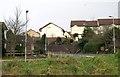
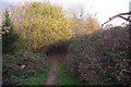
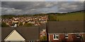
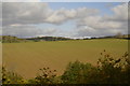
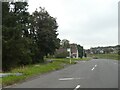
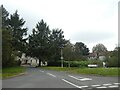

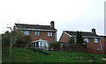
29 photos from this area
Area Information
Key information about the PL7 2GB including its size, population, and administrative classification.
- Area Type
- Postcode
- Area Size
- 5205 m²
- Population
- 1848
- Population Density
- 5802 people/km²
House Prices in PL7 2GB
24
Properties
£273,394
Average Sold Price
£214,995
Lowest Price
£354,995
Highest Price
Showing 24 properties
| Address | Type | Beds | Baths | Last Sale Price | Last Sale Date | |
|---|---|---|---|---|---|---|
| 18 Pear Lane, Plymouth, PL7 2GB | Terraced | 3 | 3 | £280,000 | Oct 2025 | |
| 32 Pear Lane, Plymouth, PL7 2GB | Terraced | 2 | 2 | £237,750 | Sep 2024 | |
| 8 Pear Lane, Plymouth, PL7 2GB | Semi-detached | 3 | 2 | £255,000 | Dec 2023 | |
| 20 Pear Lane, Plymouth, PL7 2GB | Terraced | 3 | 2 | £295,000 | Feb 2023 | |
| 16 Pear Lane, Plymouth, PL7 2GB | Retail | 3 | 2 | £300,000 | Apr 2022 | |
| 10 Pear Lane, Plymouth, PL7 2GB | Retail | 3 | 2 | £261,000 | Mar 2022 | |
| 14 Pear Lane, Plymouth, PL7 2GB | Terraced | 3 | 2 | £280,000 | Jan 2022 | |
| 17 Pear Lane, Plymouth, PL7 2GB | house | - | - | £294,995 | Dec 2019 | |
| 26 Pear Lane, Plymouth, PL7 2GB | house | - | - | £334,995 | Oct 2019 | |
| 28 Pear Lane, Plymouth, PL7 2GB | house | - | - | £217,995 | Sep 2019 |
Page 1 of 3
Energy Efficiency in PL7 2GB
Amenities
Schools
| Rank | School | Type | Entry gender | Ages |
|---|
Explore more schools in this area
Go to Schools tabDemographics
Household Size
Family (3-5 people)
most common
Accommodation Type
Houses
most common
Tenure
72
majority
Ethnic Group
White
most common
Religion
N/A
most common
Household Composition
N/A
most common
Age
47
median
Adults (30-64 years)
most common
Household Deprivation
N/A
with no deprivation
NS-SEC
33
in Lower managerial occupations
Explore more demographic insights in this area
Go to Demographics tabPlanning
Planning Constraints
- Flood RiskPremium
- Ramsar Wetland SitesPremium
- Area of Outstanding Natural BeautyPremium
- Protected Nature ReservePremium
- Protected WoodlandPremium