Area Overview for PL7 2FS
Photos of PL7 2FS
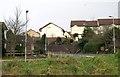
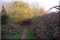
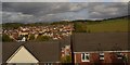
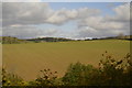
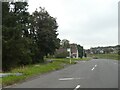
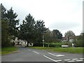

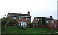
29 photos from this area
Area Information
Key information about the PL7 2FS including its size, population, and administrative classification.
- Area Type
- Postcode
- Area Size
- 1.8 hectares
- Population
- 1848
- Population Density
- 5802 people/km²
House Prices in PL7 2FS
48
Properties
£178,792
Average Sold Price
£44,000
Lowest Price
£420,000
Highest Price
Showing 48 properties
| Address | Type | Beds | Baths | Last Sale Price | Last Sale Date | |
|---|---|---|---|---|---|---|
| 12 Redwood Drive, Plymouth, PL7 2FS | Semi-detached | 3 | 1 | £246,000 | Sep 2025 | |
| 37 Redwood Drive, Plymouth, PL7 2FS | Detached | 5 | 3 | £420,000 | Apr 2024 | |
| 9 Redwood Drive, Plymouth, PL7 2FS | Detached | 3 | 1 | £326,000 | Dec 2023 | |
| 62 Redwood Drive, Plymouth, PL7 2FS | Semi-detached | 3 | 1 | £250,000 | Aug 2023 | |
| 24 Redwood Drive, Plymouth, PL7 2FS | Retail | 2 | 1 | £220,000 | Dec 2022 | |
| 31 Redwood Drive, Plymouth, PL7 2FS | Detached | 4 | 1 | £310,000 | Apr 2021 | |
| 39 Redwood Drive, Plymouth, PL7 2FS | Detached | 4 | 2 | £295,000 | Aug 2020 | |
| 18 Redwood Drive, Plymouth, PL7 2FS | Semi-detached | 2 | - | £180,000 | May 2020 | |
| 19 Redwood Drive, Plymouth, PL7 2FS | Detached | 4 | 2 | £275,000 | May 2019 | |
| 58 Redwood Drive, Plymouth, PL7 2FS | Terraced | 2 | 1 | £155,000 | Dec 2018 |
Page 1 of 5
Energy Efficiency in PL7 2FS
Amenities
Schools
| Rank | School | Type | Entry gender | Ages |
|---|
Explore more schools in this area
Go to Schools tabDemographics
Household Size
Family (3-5 people)
most common
Accommodation Type
Houses
most common
Tenure
72
majority
Ethnic Group
White
most common
Religion
N/A
most common
Household Composition
N/A
most common
Age
47
median
Adults (30-64 years)
most common
Household Deprivation
N/A
with no deprivation
NS-SEC
33
in Lower managerial occupations
Explore more demographic insights in this area
Go to Demographics tabPlanning
Planning Constraints
- Flood RiskPremium
- Ramsar Wetland SitesPremium
- Area of Outstanding Natural BeautyPremium
- Protected Nature ReservePremium
- Protected WoodlandPremium