Area Overview for PL7 2AA
Photos of PL7 2AA
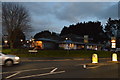
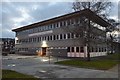
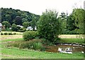
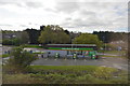
64 photos from this area
Area Information
Key information about the PL7 2AA including its size, population, and administrative classification.
- Area Type
- Postcode
- Area Size
- 4382 m²
- Population
- 1645
- Population Density
- 3197 people/km²
House Prices in PL7 2AA
13
Properties
£206,000
Average Sold Price
£164,500
Lowest Price
£247,500
Highest Price
Showing 13 properties
| Address | Type | Beds | Baths | Last Sale Price | Last Sale Date | |
|---|---|---|---|---|---|---|
| 101 Ridgeway, Plymouth, PL7 2AA | Maisonette | - | - | £247,500 | Apr 2017 | |
| 115 Ridgeway, Plymouth, PL7 2AA | Flat | - | - | £164,500 | Jul 2001 | |
| (former), 131 Ridgeway, Plymouth, PL7 2AA | undefined | - | - | - | - | |
| Clark & Weeks, 85 Ridgeway, Plymouth, PL7 2AA | shop | - | - | - | - | |
| 135-137 Ridgeway, Plymouth, PL7 2AA | restaurant_cafe | - | - | - | - | |
| 119 Ridgeway, Plymouth, PL7 2AA | retail_financial | - | - | - | - | |
| Woodside Animal Welfare Trust, 111 Ridgeway, Plymouth, PL7 2AA | house | - | - | - | - | |
| 117 Ridgeway, Plymouth, PL7 2AA | office_workshop | - | - | - | - | |
| 133-137 Ridgeway, Plymouth, PL7 2AA | Restaurant | - | - | - | - | |
| 109 RIDGEWAY, Plymouth, PL7 2AA | Terraced | - | - | - | - |
Page 1 of 2
Energy Efficiency in PL7 2AA
Amenities
Schools
| Rank | School | Type | Entry gender | Ages |
|---|
Explore more schools in this area
Go to Schools tabDemographics
Household Size
Two person
most common
Accommodation Type
Houses
most common
Tenure
75
majority
Ethnic Group
White
most common
Religion
N/A
most common
Household Composition
N/A
most common
Age
47
median
Elderly (65+ years)
most common
Household Deprivation
N/A
with no deprivation
NS-SEC
31
in Lower managerial occupations
Explore more demographic insights in this area
Go to Demographics tabPlanning
Planning Constraints
- Flood RiskPremium
- Ramsar Wetland SitesPremium
- Area of Outstanding Natural BeautyPremium
- Protected Nature ReservePremium
- Protected WoodlandPremium