Area Overview for PL7 1NB
Photos of PL7 1NB
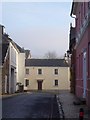


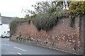


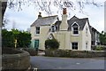

100 photos from this area
Area Information
Key information about the PL7 1NB including its size, population, and administrative classification.
- Area Type
- Postcode
- Area Size
- 1.0 hectares
- Population
- 1469
- Population Density
- 2452 people/km²
House Prices in PL7 1NB
24
Properties
£295,173
Average Sold Price
£42,000
Lowest Price
£535,000
Highest Price
Showing 24 properties
| Address | Type | Beds | Baths | Last Sale Price | Last Sale Date | |
|---|---|---|---|---|---|---|
| 54 Fore Street, Plympton, Plymouth, PL7 1NB | Terraced | 2 | 1 | £190,000 | Dec 2024 | |
| 66 Fore Street, Plympton, Plymouth, PL7 1NB | Terraced | 5 | 4 | £485,000 | Nov 2023 | |
| 50 Fore Street, Plympton, Plymouth, PL7 1NB | house | 4 | - | £280,000 | Dec 2021 | |
| Foresters Arms, 44 Fore Street, Plympton, Plymouth, PL7 1NB | Terraced | 4 | 1 | £535,000 | Jun 2021 | |
| 62 Fore Street, Plympton, Plymouth, PL7 1NB | Terraced | 3 | 2 | £398,000 | May 2021 | |
| 58 Fore Street, Plympton, Plymouth, PL7 1NB | Terraced | 3 | 2 | £317,000 | Jun 2020 | |
| 85 Fore Street, Plympton, Plymouth, PL7 1NB | Terraced | 2 | - | £199,000 | Jul 2019 | |
| 52 Fore Street, Plympton, Plymouth, PL7 1NB | Detached | 5 | 3 | £310,000 | Nov 2018 | |
| 46 Fore Street, Plympton, Plymouth, PL7 1NB | Terraced | 3 | 2 | £450,000 | Aug 2018 | |
| 70 Fore Street, Plympton, Plymouth, PL7 1NB | Cottage | 4 | 1 | £277,000 | Sep 2017 |
Page 1 of 3
Energy Efficiency in PL7 1NB
Amenities
Schools
| Rank | School | Type | Entry gender | Ages |
|---|
Explore more schools in this area
Go to Schools tabDemographics
Household Size
Family (3-5 people)
most common
Accommodation Type
Houses
most common
Tenure
78
majority
Ethnic Group
White
most common
Religion
N/A
most common
Household Composition
N/A
most common
Age
47
median
Adults (30-64 years)
most common
Household Deprivation
N/A
with no deprivation
NS-SEC
37
in Lower managerial occupations
Explore more demographic insights in this area
Go to Demographics tabPlanning
Planning Constraints
- Flood RiskPremium
- Ramsar Wetland SitesPremium
- Area of Outstanding Natural BeautyPremium
- Protected Nature ReservePremium
- Protected WoodlandPremium