Area Overview for PL6 8SZ
Photos of PL6 8SZ
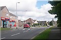
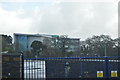
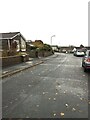
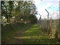
11 photos from this area
Area Information
Key information about the PL6 8SZ including its size, population, and administrative classification.
- Area Type
- Postcode
- Area Size
- 2.2 hectares
- Population
- 1324
- Population Density
- 1668 people/km²
House Prices in PL6 8SZ
28
Properties
£116,864
Average Sold Price
£41,000
Lowest Price
£175,000
Highest Price
Showing 28 properties
| Address | Type | Beds | Baths | Last Sale Price | Last Sale Date | |
|---|---|---|---|---|---|---|
| 16 Rogate Walk, Plymouth, PL6 8SZ | Terraced | 2 | 1 | £175,000 | May 2022 | |
| 28 Rogate Walk, Plymouth, PL6 8SZ | house | - | - | £168,000 | Oct 2021 | |
| 1 Rogate Walk, Plymouth, PL6 8SZ | Terraced | 2 | 1 | £108,750 | Mar 2021 | |
| 29 Rogate Walk, Plymouth, PL6 8SZ | Terraced | 2 | 1 | £140,000 | Sep 2019 | |
| 4 Rogate Walk, Plymouth, PL6 8SZ | Semi-detached | 2 | 1 | £139,000 | May 2018 | |
| 27 Rogate Walk, Plymouth, PL6 8SZ | Terraced | 2 | 1 | £141,000 | Nov 2017 | |
| 5 Rogate Walk, Plymouth, PL6 8SZ | Terraced | 2 | 1 | £155,000 | Jul 2017 | |
| 25 Rogate Walk, Plymouth, PL6 8SZ | house | - | - | £132,000 | Jan 2014 | |
| 23 Rogate Walk, Plymouth, PL6 8SZ | Terraced | - | - | £109,500 | Oct 2011 | |
| 15 Rogate Walk, Plymouth, PL6 8SZ | house | 2 | - | £111,500 | Aug 2010 |
Page 1 of 3
Energy Efficiency in PL6 8SZ
Amenities
Schools
| Rank | School | Type | Entry gender | Ages |
|---|
Explore more schools in this area
Go to Schools tabDemographics
Household Size
Two person
most common
Accommodation Type
Houses
most common
Tenure
81
majority
Ethnic Group
White
most common
Religion
N/A
most common
Household Composition
N/A
most common
Age
47
median
Adults (30-64 years)
most common
Household Deprivation
N/A
with no deprivation
NS-SEC
32
in Lower managerial occupations
Explore more demographic insights in this area
Go to Demographics tabPlanning
Planning Constraints
- Flood RiskPremium
- Ramsar Wetland SitesPremium
- Area of Outstanding Natural BeautyPremium
- Protected Nature ReservePremium
- Protected WoodlandPremium