Area Overview for PL6 8FY
Photos of PL6 8FY
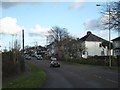
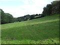

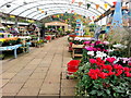
12 photos from this area
Area Information
Key information about the PL6 8FY including its size, population, and administrative classification.
- Area Type
- Postcode
- Area Size
- 1.1 hectares
- Population
- 1957
- Population Density
- 2118 people/km²
House Prices in PL6 8FY
29
Properties
£282,500
Average Sold Price
£240,000
Lowest Price
£315,513
Highest Price
Showing 29 properties
| Address | Type | Beds | Baths | Last Sale Price | Last Sale Date | |
|---|---|---|---|---|---|---|
| 19 Starling Drive, Plymouth, PL6 8FY | Semi-detached | 3 | 2 | £285,000 | Jul 2025 | |
| 53 Starling Drive, Plymouth, PL6 8FY | house | 4 | 2 | £297,000 | Mar 2024 | |
| 59 Starling Drive, Plymouth, PL6 8FY | Semi-detached | 3 | 2 | £303,000 | Jan 2024 | |
| 11 Starling Drive, Plymouth, PL6 8FY | house | - | - | £315,000 | Jul 2023 | |
| 25 Starling Drive, Plymouth, PL6 8FY | Semi-detached | 3 | 2 | £269,995 | Dec 2021 | |
| 23 Starling Drive, Plymouth, PL6 8FY | house | - | - | £296,500 | Dec 2021 | |
| 49 Starling Drive, Plymouth, PL6 8FY | house | - | - | £292,000 | Nov 2021 | |
| 57 Starling Drive, Plymouth, PL6 8FY | house | - | - | £244,000 | Nov 2021 | |
| 55 Starling Drive, Plymouth, PL6 8FY | house | - | - | £276,995 | Oct 2021 | |
| 51 Starling Drive, Plymouth, PL6 8FY | house | - | - | £271,495 | Oct 2021 |
Page 1 of 3
Energy Efficiency in PL6 8FY
Amenities
Schools
| Rank | School | Type | Entry gender | Ages |
|---|
Explore more schools in this area
Go to Schools tabDemographics
Household Size
Family (3-5 people)
most common
Accommodation Type
Houses
most common
Tenure
55
majority
Ethnic Group
White
most common
Religion
N/A
most common
Household Composition
N/A
most common
Age
47
median
Adults (30-64 years)
most common
Household Deprivation
N/A
with no deprivation
NS-SEC
35
in Lower managerial occupations
Explore more demographic insights in this area
Go to Demographics tabPlanning
Planning Constraints
- Flood RiskPremium
- Ramsar Wetland SitesPremium
- Area of Outstanding Natural BeautyPremium
- Protected Nature ReservePremium
- Protected WoodlandPremium