Area Overview for PL6 6PJ
Photos of PL6 6PJ


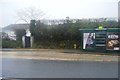
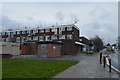
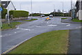


37 photos from this area
Area Information
Key information about the PL6 6PJ including its size, population, and administrative classification.
- Area Type
- Postcode
- Area Size
- 9171 m²
- Population
- 1443
- Population Density
- 2906 people/km²
House Prices in PL6 6PJ
25
Properties
£190,139
Average Sold Price
£110,000
Lowest Price
£290,000
Highest Price
Showing 25 properties
| Address | Type | Beds | Baths | Last Sale Price | Last Sale Date | |
|---|---|---|---|---|---|---|
| 9 Barndale Crescent, Plymouth, PL6 6PJ | house | 3 | 1 | £290,000 | Nov 2025 | |
| 32 Barndale Crescent, Plymouth, PL6 6PJ | Retail | 3 | 1 | £273,000 | Jun 2022 | |
| 5 Barndale Crescent, Plymouth, PL6 6PJ | house | - | - | £135,000 | Apr 2021 | |
| 17 Barndale Crescent, Plymouth, PL6 6PJ | Semi-detached | - | - | £275,000 | Mar 2021 | |
| 23 Barndale Crescent, Plymouth, PL6 6PJ | house | - | - | £180,000 | Jan 2021 | |
| 24 Barndale Crescent, Plymouth, PL6 6PJ | Semi-detached | 3 | 1 | £222,500 | Dec 2020 | |
| 3 Barndale Crescent, Plymouth, PL6 6PJ | Semi-detached | 3 | 1 | £195,000 | Dec 2017 | |
| 22 Barndale Crescent, Plymouth, PL6 6PJ | Semi-detached | 3 | - | £170,000 | Jun 2017 | |
| 8 Barndale Crescent, Plymouth, PL6 6PJ | Semi-detached | 4 | 2 | £220,000 | Oct 2016 | |
| 38 Barndale Crescent, Plymouth, PL6 6PJ | Semi-detached | 4 | - | £215,000 | Jun 2014 |
Page 1 of 3
Energy Efficiency in PL6 6PJ
Amenities
Schools
| Rank | School | Type | Entry gender | Ages |
|---|
Explore more schools in this area
Go to Schools tabDemographics
Household Size
Two person
most common
Accommodation Type
Houses
most common
Tenure
88
majority
Ethnic Group
White
most common
Religion
N/A
most common
Household Composition
N/A
most common
Age
47
median
Adults (30-64 years)
most common
Household Deprivation
N/A
with no deprivation
NS-SEC
35
in Lower managerial occupations
Explore more demographic insights in this area
Go to Demographics tabPlanning
Planning Constraints
- Flood RiskPremium
- Ramsar Wetland SitesPremium
- Area of Outstanding Natural BeautyPremium
- Protected Nature ReservePremium
- Protected WoodlandPremium