Area Overview for PL6 6BD
Photos of PL6 6BD


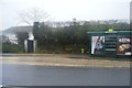
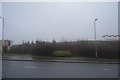
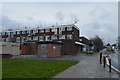
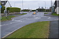


37 photos from this area
Area Information
Key information about the PL6 6BD including its size, population, and administrative classification.
- Area Type
- Postcode
- Area Size
- 1.5 hectares
- Population
- 1732
- Population Density
- 2274 people/km²
House Prices in PL6 6BD
33
Properties
£212,815
Average Sold Price
£72,500
Lowest Price
£420,000
Highest Price
Showing 33 properties
| Address | Type | Beds | Baths | Last Sale Price | Last Sale Date | |
|---|---|---|---|---|---|---|
| 42 Upland Drive, Plymouth, PL6 6BD | Detached | 3 | 2 | £360,000 | Nov 2025 | |
| 27 Upland Drive, Plymouth, PL6 6BD | Retail | 4 | 1 | £308,000 | May 2022 | |
| 50 Upland Drive, Plymouth, PL6 6BD | house | - | - | £305,000 | Nov 2021 | |
| 56 Upland Drive, Plymouth, PL6 6BD | house | - | - | £280,000 | Dec 2020 | |
| 32 Upland Drive, Plymouth, PL6 6BD | house | 3 | - | £260,000 | Nov 2020 | |
| 52 Upland Drive, Plymouth, PL6 6BD | house | - | - | £246,000 | Dec 2018 | |
| 44 Upland Drive, Plymouth, PL6 6BD | Semi-detached | 2 | - | £420,000 | Aug 2018 | |
| 54 Upland Drive, Plymouth, PL6 6BD | Terraced | 3 | - | £227,000 | Nov 2016 | |
| 40 Upland Drive, Plymouth, PL6 6BD | Semi-detached | 3 | - | £245,000 | Oct 2014 | |
| 48 Upland Drive, Plymouth, PL6 6BD | Detached | 3 | 2 | £181,000 | Apr 2014 |
Page 1 of 4
Energy Efficiency in PL6 6BD
Amenities
Schools
| Rank | School | Type | Entry gender | Ages |
|---|
Explore more schools in this area
Go to Schools tabDemographics
Household Size
Two person
most common
Accommodation Type
Houses
most common
Tenure
92
majority
Ethnic Group
White
most common
Religion
N/A
most common
Household Composition
N/A
most common
Age
47
median
Adults (30-64 years)
most common
Household Deprivation
N/A
with no deprivation
NS-SEC
42
in Lower managerial occupations
Explore more demographic insights in this area
Go to Demographics tabPlanning
Planning Constraints
- Flood RiskPremium
- Ramsar Wetland SitesPremium
- Area of Outstanding Natural BeautyPremium
- Protected Nature ReservePremium
- Protected WoodlandPremium