Area Overview for PL6 6AF
Photos of PL6 6AF
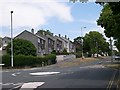
16 photos from this area
Area Information
Key information about the PL6 6AF including its size, population, and administrative classification.
- Area Type
- Postcode
- Area Size
- 2.5 hectares
- Population
- 1613
- Population Density
- 2383 people/km²
House Prices in PL6 6AF
18
Properties
£387,909
Average Sold Price
£181,000
Lowest Price
£615,000
Highest Price
Showing 18 properties
| Address | Type | Beds | Baths | Last Sale Price | Last Sale Date | |
|---|---|---|---|---|---|---|
| 97 Powisland Drive, Plymouth, PL6 6AF | Detached | 4 | 2 | £490,000 | Jun 2025 | |
| 106 Powisland Drive, Plymouth, PL6 6AF | Detached | 4 | 1 | £555,000 | Jun 2023 | |
| 102 Powisland Drive, Plymouth, PL6 6AF | Detached | 4 | 2 | £615,000 | Dec 2022 | |
| 110 Powisland Drive, Plymouth, PL6 6AF | Detached | 4 | 1 | £420,000 | Dec 2020 | |
| 95 Powisland Drive, Plymouth, PL6 6AF | Detached | 6 | 3 | £445,000 | Oct 2019 | |
| 93 Powisland Drive, Plymouth, PL6 6AF | Detached | 4 | 1 | £380,000 | Feb 2017 | |
| 112 Powisland Drive, Plymouth, PL6 6AF | Detached | 4 | - | £291,000 | Aug 2015 | |
| 116 Powisland Drive, Plymouth, PL6 6AF | house | 4 | - | £250,000 | Feb 2012 | |
| 108 Powisland Drive, Plymouth, PL6 6AF | house | - | - | £300,000 | Nov 2009 | |
| 120 Powisland Drive, Plymouth, PL6 6AF | Detached | 5 | 2 | £340,000 | Sep 2007 |
Page 1 of 2
Energy Efficiency in PL6 6AF
Amenities
Schools
| Rank | School | Type | Entry gender | Ages |
|---|
Explore more schools in this area
Go to Schools tabDemographics
Household Size
Two person
most common
Accommodation Type
Houses
most common
Tenure
77
majority
Ethnic Group
White
most common
Religion
N/A
most common
Household Composition
N/A
most common
Age
47
median
Adults (30-64 years)
most common
Household Deprivation
N/A
with no deprivation
NS-SEC
36
in Lower managerial occupations
Explore more demographic insights in this area
Go to Demographics tabPlanning
Planning Constraints
- Flood RiskPremium
- Ramsar Wetland SitesPremium
- Area of Outstanding Natural BeautyPremium
- Protected Nature ReservePremium
- Protected WoodlandPremium