Area Overview for PL6 5XZ
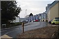
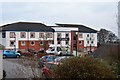
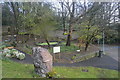
Photos of PL6 5XZ


Area Information
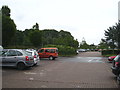
PL6 5XZ represents a specific residential cluster in Plymouth, distinct for its concentrated housing and relatively small population. With 2,805 residents packed into a limited space, the area achieves a population density of 1,140 people per square kilometre. This creates a close-knit environment where daily life moves at a specific clip, balancing the convenience of proximity with the potential noise of higher density living. The postcode serves as a hub for targeted homeownership and family living within the broader city boundaries. Residents here experience a community defined by practicality and shared local resources rather than expansive streets or sprawling suburbs. The nature of this postcode means you navigate a compact neighbourhood where every facility is nearby, yet the sheer concentration of households in such a defined area fosters a particular sense of local identity. Living in PL6 5XZ offers immediate access to the wider amenities of Plymouth while maintaining a focused residential footprint.
- Area Type
- Postcode
- Area Size
- Not available
- Population
- 2805
- Population Density
- 1140 people/km²
The property market in PL6 5XZ is characterised by a strong preference for owner-occupied housing. With 60% of residents owning their homes, the area functions more as an established owner-occupied zone than a transient rental market. This high rate of homeownership suggests that properties here attract buyers looking for stability and long-term tenure. The dominant accommodation type is houses, meaning the streets are lined with traditional residential buildings rather than purpose-built flats or blocks of reasoning. For buyers searching for homes in PL6 5XZ, this indicates a market driven by individuals who have bought into the neighbourhood rather than tenants living from year to year. While the specific pricing figures are not listed in the local profile, the structural data paints a picture of a stable housing stock. The prevalence of houses aligns with the family-oriented nature of the area, where space and ownership are prioritised. Prospective buyers should approach this postcode knowing they enter a market defined by permanence and house ownership rather than the fluidity of the private rental sector.
House Prices in PL6 5XZ
No properties found in this postcode.
Energy Efficiency in PL6 5XZ
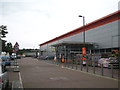
Residents of PL6 5XZ enjoy practical access to a variety of retail and transport hubs within walking or short driving distance. Five notable retail outlets are located near the area, including M&S Plymouth, M&S Derriford, and Farmfoods Honicknowle. These specific stores provide everyday necessities alongside larger supermarket requirements, removing the need for long trips to the city centre. Transport options are extensive, with five railway stations available, including Plymouth Railway Station and St Budeaux Victoria Road Railway Station. These links facilitate easy travel across the South West. Furthermore, two airports, both named Plymouth City Airport, are situated nearby for air travel needs. Maritime transport is also accessible through five ferry terminals, such as the Plymouth Mount Batten Ferry Landing and Plymouth Ferry Terminal. Living in PL6 5XZ means you are surrounded by these logistical centres. The combination of diverse retail chains and multiple transport modes makes daily errands and commuting straightforward. You benefit from a neighbourhood that prioritises connectivity and commercial convenience for its residents.
Amenities
Schools
Families living in PL6 5XZ have access to a mix of specialist and mainstream educational institutions in the immediate vicinity. St Matthew's Church of England Primary and Nursery Academy operates nearby with a 'good' Ofsted rating, providing a solid foundation for primary education. Further along the educational spectrum, the Plymouth Studio School serves as a secondary option for teenagers. Specialised needs are met through Plymouth Hospital & Outreach School, ensuring comprehensive care for pupils with complex requirements. Additionally, the University of St Mark & St John is situated close to the area, catering to higher education students and potentially influencing the local youth population. This blend of primary, secondary, specialist, and higher education providers creates a robust educational ecosystem. Living in PL6 5XZ means you are close to a diverse range of schooling options, from the rated care of St Matthew's to the vocational focus of the Studio School. You do not need to travel far to find institutions that cater to different stages of learning and specific student needs.
| Rank | School | Type | Entry gender | Ages |
|---|
Explore more schools in this area
Go to Schools tabDemographics
The community in PL6 5XZ is defined by a young demographic structure and strong stability in home ownership. The median age stands at just 22 years, indicating a youthful population presence despite the data noting adults aged 30 to 64 as the most common age range in terms of sheer numbers. This contradiction suggests a significant cohort of young professionals or families settling into these homes. Stability is a key feature, with 60% of the population owning their homes outright rather than renting. This majority of owner-occupied households implies a settled community invested in the local footprint. The accommodation type is predominantly houses, distinguishing the area from typical urban bedroom communities dominated by flats. Ethnically, the area is overwhelmingly White, reflecting a traditional demographic makeup common across Plymouth. Living in this postcode means joining a community where ownership drives the social fabric, and the housing stock caters primarily to those seeking their own detached or semi-detached home rather than high-density apartment living.
Household Size
Accommodation Type
Tenure
Ethnic Group
Religion
Household Composition
Age
Household Deprivation
NS-SEC
Explore more demographic insights in this area
Go to Demographics tabPlanning
Planning Constraints
- Flood RiskPremium
- Ramsar Wetland SitesPremium
- Area of Outstanding Natural BeautyPremium
- Protected Nature ReservePremium
- Protected WoodlandPremium